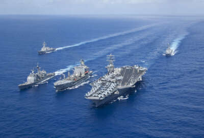
A look at Naval weather-tracking activities in the western Pacific Ocean
Commander Angela Francis is commanding officer of the Joint Typhoon Warning Center. She joined the Federal Drive with Tom Temin from Pearl Harbor, Hawaii to tel...
Best listening experience is on Chrome, Firefox or Safari. Subscribe to Federal Drive’s daily audio interviews on Apple Podcasts or PodcastOne.
Pearl Harbor, Hawaii — Nobody likes typhoons, tropical storms in the Western Pacific, least of all the US Navy’s third, fifth and seventh fleets. That’s where the Joint Typhoon Warning Center (JTWC) comes in. Part of the Naval Meteorology and Oceanography Command, it’s one of the activities we’re exploring in this week’s series on how the Navy keeps on top of the weather. Commander Angela Francis is commanding officer of the Joint Typhoon Warning Center. She joined the Federal Drive with Tom Temin from Pearl Harbor, Hawaii.
Tom Temin Well tell us what a specific mission is here.
Angela Francis Sure. Yeah. So Joint Typhoon Warning Center is a very niche role in global and regional forecasting. We provide analysis forecasts, of course, and decision support to the whole of U.S. government and the DoD to make decisions as they plan, prepare and protect against the threat of tropical cyclones, as you mentioned, in the third, fifth and seventh fleet areas of responsibility (AORs). And more broadly, we say across the Indo-Pacific region, and that includes both the Pacific and Indian Oceans.
Tom Temin And you report up through the Weather Center of San Diego.
Angela Francis That’s correct. They have a harshly global mission of providing all sorts of weather support to our fleet assets. And naturally, Joint Typhoon Warning Center has a big role in that as we help inform decision makers how a cyclone could affect fleet movement.
Tom Temin Now, if the weather center is looking at the weather in half of the world, that includes Hawaii, and I guess all the way over to the coast of Japan and so forth, what does the Joint Typhoon Warning Center do that the weather center does not do?
Angela Francis Well, we provide one element of the forecasts that overall would be delivered through the fleet Weather Center because they provide something called ship routing, where they actually move ships around hazardous weather. And the element that we provide because of the expertise of our watchstanders, is very pointed tropical cyclone forecasts. I call it a little bit of a niche, but it does require very specific tools and reconnaissance to be able to forecast a tropical cyclone or a typhoon.
Tom Temin And a typhoon, just for those of us that are in the lay here with respect to weather, that’s basically a tornado that’s over water.
Angela Francis Well, so I get that question a lot. What’s the difference between a hurricane, a cyclone and a typhoon? And the trick answer is there’s no difference. So they’re all called tropical cyclones. And the typhoon is actually just a specific name that we give any cyclone that’s in the Western Pacific region. So think, along the Philippines, Japan and the Western Pacific island chain there, whereas a hurricane is just a more specific name that we give to a cyclone that impacts the mainland Americas. So they’re all cyclones and typhoons are what we probably are most known for because that part of the globe has a whole lot of cyclone activities. That being the Western Pacific.
Tom Temin So there are also storms, then that are not cyclic, they don’t rotate, and those would not be considered typhoons, but just still whether you want to avoid.
Angela Francis Absolutely. And you know, the fun thing about a typhoon or a tropical cyclone is they’ll have a lot of that weather embedded in it. You’ll have horrible possibilities of tornadoes and thunderstorms, severe winds, and then they also uniquely bring elements of bad weather like storm surge, flash flooding, which as you can imagine is of particular interest to coastal regions, and island nations that are sprinkled throughout the Pacific and Indian oceans.
Tom Temin And in the civilian world, one of the big holy grails for hurricane cyclonic prediction is the further you know in advance, the better you can warn people and so forth. What are some of the advances, whether it’s in data science or information technology that is allowing earlier and earlier predictions of where a cyclonic storm or typhoon might take place?
Angela Francis Well, you really nailed what we’re always trying to do here, right, is just to extend that range of notification further and further out. Right now, you can actually go to like a website for JTWC and see that we have a two week outlook product. And what goes into that as a whole bunch of stuff. We include reconnaissance, we include analysis and of course, long and medium range models. And those models are always improving in skill such that we can have a better idea further and further out when we think an area might be a potential cyclone. And once we really hone in to that particular area based on this analysis, and forecast and reconnaissance availability, we can start actually doing things to the model to kind of manipulate it to say we think this could be an area of interest — we call it an invest area — and that will trigger the models to actually take a harder look at something that’s very unique to a cyclone in the way that they are created that a normal model might not actually be able to pick up. And that almost feeds the model in a way where we can expect it to continue to develop appropriately, an actual cyclone. And then from there, we just keep an eye on it. And then when cyclone develops that’s actually a pretty easy forecasting problem to solve. It’s always knowing the areas to focus on before they really get going. We’re getting to a point now where with this two week outlook product, we can increase the decision making cycle by a good five to seven days further out than we used to, even as recently as two or three years ago.
Tom Temin So it sounds like something that a human observer may not be able to help you with. For example, if someone’s on the deck of a ship, and they say, the wind just reversed direction and the radio that in, you probably knew that already.
Angela Francis Certainly, that’s how we hope the situation will go, right. If the first clue that we have of an inbound cyclone is from an observer, say on the deck of a carrier, then we’re not doing our job adequately to provide them the heads up that something’s coming. Now, what we will call that is like an in situ observation, you know, it’s an opportunity to validate what we think is already happening. And so that is very useful information. But the goal is always to make sure that our fleet and forces are well out of the way of the system such that hopefully, they’re not in a position to be giving us real time observations. But they are useful in the sense that they can help us validate our forecasts and what we understand the models to be showing us.
Tom Temin We were speaking with Navy Commander Angela Francis, commanding officer of the Joint Typhoon Warning Center in Honolulu, Hawaii. And let me ask you this, what sort of infrastructure equipment, instrumentation sensors, what do you have in terms of resources to carry out this mission?
Angela Francis We actually tap into resources that are kind of available on a global scale. Our biggest resource, of course, is our people. But I’m going to talk about them last. Before we really get into the forecasting, we have to have good data. And the data for this particular mission mostly comes through satellites— and that’s both geostationary satellites and what we call polar orbiting satellites that have unique sensors on them, to give us data that helps us really be able to discern where the center of a cyclone is starting to develop, because we can really pick up on wind speed and direction and kind of show us that there’s a circulation. And so without that data, we’re a little bit shooting in the blind, especially across this huge Pacific and Indian Ocean area of responsibility. Now, once we have that as sort of a great starting point of where to focus, we use that data to initialize our models. And of course, use of numerical weather model prediction is absolutely essential to our ability for the forecasters to then jump in and start applying their very specific expertise to build a forecast. And so that’s where I’ll land is, you know, I look at JTWC’s center of gravity is actually our people. We have a small team of elite, what we call, typhoon duty officers. And so they’re specially trained when forecasting this very unique phenomenon, which is not necessarily like every other meteorological problem. Right? This is very specific to something called tropical meteorology.
Tom Temin And so to be clear, then National Weather Service, what National Oceanic and Atmospheric Administration (NOAA) might be doing and other agencies like that, that have all the supercomputing capabilities, and sensors around the world. That’s all part of your, let’s say virtual infrastructure.
Angela Francis Absolutely, we have an excellent relationship with NOAA— relationship partnership, inter-agency cooperation. And that is through working closely with the National Hurricane Center and the Central Pacific Hurricane Center. We share our data and our resources. And that’s all connected virtually, of course. In the battle to get as much data in front of you to build a forecast, they play a very, very important role in that.
Tom Temin And talk a little bit more about the human capital that you have. How many people work in the warning center? Is it mostly military? Do you have a mix of civilians? What about contractors?
Angela Francis Well, the answer is all the above, right. So we actually are unique. We have this title called Joint Typhoon Warning Center, which implies that we have more than just Navy personnel here. So this mission is conducted using both Navy and Air Force officers, enlisted and civilians. And we do have a couple of contractors as well. And they all play a very important role in the typhoon forecasting mission. Certainly our civilians come in with specialty training, our enlisted come in with a special forecasting qualification. And then our officers have a breadth of knowledge. Some of them have specific meteorology backgrounds, and others are actually just put through a really rigorous training program that we do completely in house to teach them how to do a good typhoon forecast. And that puts them up to the same level as our civilians who have been doing these for decades and have a background in tropical meteorology. And then that relationship develops such that the more senior civilians who do this regularly, they’re kind of the continuity of our mission, they become mentors to the junior officers and enlisted and all together they work together to make this great accurate forecast for typhoons. And it’s a small footprint. Our command on this side of the mission is only about 45 people. We have a 24/7 watch floor. Even if there’s no cyclone to be forecasted on, we’re always monitoring areas of potential development. So it is a 24/7 process. And we have at all times one typhoon duty officer on the watch floor. If we get to a situation where we’re actually forecasting more than two cyclones at any given time, we’ll have to augment that watch. And you’ll see that we’ll have at that time, two typhoon duty officers, just because it’s a pretty hairy and involved process to do a complete forecast, and they have to redo it every six hours. So you can imagine like one person trying to do that for several storms, it starts to become unmanageable and will actually augment the team. But yeah, it’s a small team here.
Tom Temin And finally, how did you come to do this particular work for the Navy?
Angela Francis I actually don’t have a background in tropical meteorology, but I am a meteorology and oceanography (METOC) officer, part of the cadre of officers that fall under the Naval Meteorology and Oceanography Center. So I do have specialty training and education within the realm of meteorology and oceanography. How I ended up being the commanding officer here is just through a rigorous screening process determined that my leadership acumen is such that I would be a good fit for this location. In this job, I would say that I’m here to be an advocate for all of my active duty and civilian personnel, to use my tools of leadership and understanding of big Navy to help bring resources to the team. I’m less about maybe being the smartest person in the room about a tropical forecast. So that’s what I bring to them. And they have all of this science background to ensure that as a team, we’re making the vision of the command and the mission accomplished every single day.
Tom Temin And it’s never too bad to be in Hawaii because it’s Hawaii and your way away from the Pentagon.
Angela Francis That’s right, six hours behind them in fact.
Tom Temin Navy Commander Angela Francis, is commanding officer of the Joint Typhoon Warning Center in Honolulu. Thanks so much for joining me.
Angela Francis Absolutely. It was a pleasure to be able to talk about our mission in our people here. Thank you.
Tom Temin Tomorrow, we conclude our series on naval oceanography operations when we check in with the Mine Warfare Center.
Copyright © 2024 Federal News Network. All rights reserved. This website is not intended for users located within the European Economic Area.


Tom Temin
Tom Temin is host of the Federal Drive and has been providing insight on federal technology and management issues for more than 30 years.
Follow @tteminWFED