Hubbard Radio Washington DC, LLC. All rights reserved. This website is not intended for users located within the European Economic Area.
On Air: Federal News Network
High winds, sea warnings: How the Fleet Weather Center keeps the Navy safe
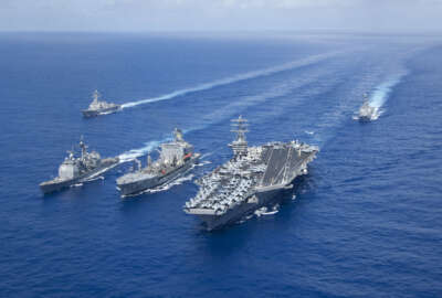
Large and heavy as they might be, the Navy's ships are affected by weather. Operations and planning depend on knowing what the weather will bring.
Best listening experience is on Chrome, Firefox or Safari. Subscribe to Federal Drive’s daily audio interviews on Apple Podcasts or PodcastOne.
Large and heavy as they might be, the Navy’s ships are affected by weather. Operations and planning depend on knowing what the weather will bring. The Federal Drive with Tom Temin begins the first in a series of interviews exploring the mission of the Fleet Weather Center in Norfolk, Virginia with Capt. Erin Acosta, the center’s commanding officer.
Interview transcript:
Tom Temin: Capt. Acosta. Good to have you on.
Erin Acosta: Yes, thank you very much. Thank you for the opportunity today.
Tom Temin: And just begin by telling us where the Fleet Weather Center fits in the general Department of the Navy hierarchy here.
Erin Acosta: Yeah, absolutely. Thank you for the question. So we’re part of the Naval Oceanography Community, and we fall within the information warfare community writ large for the Navy. So I’m one of six major commands within the Naval Oceanography Community, and I’m one of two fleet weather centers, my sister center is in San Diego, California. So we each span roughly half the globe in our support for the fleet.
Tom Temin: That kind of answers my next question, what is the scope of the area? I guess it’s the East Coast all the way around to where the San Diego side leaves off going west?
Erin Acosta: Absolutely. So we’ve covered many airfields in the eastern section of the United States cover the Gulf Coast, the eastern seaboard across the Atlantic and Mediterranean until about the Suez Canal, I do have some forecasting responsibility coverage in CENTCOM, but mainly Suez Canal west.
Tom Temin: Got it. And I guess, is it fair to say that operation of a ship versus operation of aircraft, and I guess, perhaps you can tell me operation of submarines each have different weather parameters, weather effects that they care the most about?
Erin Acosta: Yeah, absolutely, Tom. So that’s part of our mission as we provide a shore based reach back capability to any fleet asset that does not have an organic METOC, meteorology and oceanography support system or unit and so we absolutely provide forecast support for surface ships, for aircraft as well as submarines, and even different ships and different type of aircraft platforms all have capabilities and limitations, or how the weather will affect their ride, their capability and their systems on board. So that’s really where we come into play.
Tom Temin: And for an aircraft carrier, this is just kind of a detail question. Could it be that you could find that well, things on the surface are pretty calm, so you’re not landing on a bobbing cork, but when you get upstairs, there’s lots of things to worry about?
Erin Acosta: Yes, absolutely. So I have two subordinate commander commands that fall under my purview, one of them being the Strike Group Oceanography Team Norfolk, and so that command deploys what we call a unit of airographers mates forecasters, weather forecasters onboard the carriers in the large check amphib[ious vehicles] to support a range of operations, everything from anti-submarine warfare to surface and how the carrier and the company ships are riding, as well as their aircraft. And not just to your point launch and recovery, but also maneuvering around any significant weather systems, whether they’re conducting operations or exercise.
Tom Temin: And what is the output of your center? Is it advisories? Is it graphics of the atmosphere? I mean, what do you actually deliver?
Erin Acosta: Yeah, absolutely. We deliver both. From a weather forecast standpoint, we forecast and provide graphic and text weather forecasts for surface ships, for aviation assets, as well as for submarines. We also produce in the Atlantic basin and Gulf basin, high winds and sea warnings. And so the fleet is aware of where conditions may be hazardous to their operations. We also provide tropical cyclone support. And so we are the Navy’s dissemination node if you will, for the National Hurricane Center forecasts and service products during the hurricane season. And so not only do we ensure that fleet assets and naval installations receive that information, but then we forecast onset of hazardous weather. So surge, tidal concerns, winds as well as rain amounts that they can expect as well as the onset and that really informs installations along the Gulf Coast and eastern seaboard such things as do they need to sortie the fleet? Do they need to shut down the base and when do they need to shut down certain services as well as the recovery aspect on the other side, so we’re really providing those point forecast installations.
Tom Temin: We’re speaking with Capt. Erin Acosta, Commanding Officer of the Navy’s fleet Weather Center in Norfolk, Virginia, and just describe for us the type of infrastructure, instrumentation, equipment capabilities you have to be able to gather data and predict the weather and weather patterns.
Erin Acosta: Our building is onboard Naval Station Norfolk, and we have a myriad of either incoming satellite information so satellite graphics observations, as well as National Weather Service provided observations and forecasts when it comes to our assets within the United States, the Naval activities like airfields within the United States. And then we have forecaster toolkits, computer systems and programs that our forecasters use to produce and disseminate their products. We very much have a partnership with the National Weather Service and the National Hurricane Center, as we already discussed when it comes to our continental United States fleet activities, where we have aircraft and where we have ships.
Tom Temin: And way out in the middle of the Atlantic Ocean, for example, probably the National Weather Service, do they leave that to you to predict and look at? I mean, do you have the capability of predicting Mid-Atlantic or South Atlantic weather?
Erin Acosta: We absolutely do. So one of our major centers within Naval Oceanography is Fleet Numerical Meteorology and Oceanography Center, and they really produce our atmospheric and our oceanographic modeling. So we ingest upwards of 40 million observations a day either by organic surface buoys, ships and aircraft that are taking weather observations or satellite based observations, and we ingest that and the models and then we use the models to produce our forecasts. Obviously, when we’re in the middle of the ocean where that data is sparse, that’s why it’s important that we have those forecasters onboard those surface units. So they can use their eyes as well, when it comes to sea state, as well as using organic radars and such on the actual aircraft carriers. And so if we need to do flight operations in and around thunderstorms, for example, we can do that. And we can do that safely. So the ship CO and the warfighters can conduct their missions safely and maximise on time station.
Tom Temin: And humans actually are pretty good sensors with eyes and you can even smell changes in weather, I’ve noticed. So is that at least at the peripheral, a little bit of it, those people out there on the ships?
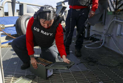
Erin Acosta: Yeah, absolutely both the forecasters on the ships. And when we talk about producing our forecasts for the ships and platforms, we’re not just talking about supporting the actual platform and how it might be riding on sea, very important, but we’re also looking at different weapon systems on the ships and how they’re going to be impacted by the weather from an electromagnetic spectrum standpoint, and as well as human weapons systems or humans as well. They’re impacted by cold weather and hot weather and rain and so on and so forth. When they’re out on the flight deck. But yes, our observers absolutely do take observations at sea. And that goes into account when we produce our forecasts.
Tom Temin: So therefore, the platforms that are served by the weather forecasts are also sensors to help produce the weather forecasts.
Erin Acosta: They are submarines surface ships, aircraft alike, as well as autonomous vehicles and autonomous sensors that our community, Naval Oceanography deploys around the globe.
Tom Temin: And what are some of the human capital requirements? Give us the scope of how many people work there? How many uniforms, civilians, contractors operationally, what do you look like in terms of people?
Erin Acosta: Yes, so we have a combination of IT and data analysts, big data movement type expertise onboard, as well as civilian military, military and officers and enlisted forecasts personnel with some contract support where and as needed. So locally, at Fleet Weather Center Norfolk, we’re predominantly military, we have about 160 folks on board 35 of which are civilians. My civilians are a mixture from administrative, to security, to IT, to actual forecasters. But for example, you might have different dynamics. One of my subordinate, 05 commander commands is the U.S. National Ice Center. So they provide global to tactical snow and ice forecasting where the nation needs it. So not only to Navy, but to the Department of Defense. And so they are opposite in their demographics where there are civilian heavily, particularly master ice analysts. So it really just depends on where you sit and where you are in a community, whether it’s predominantly military or predominantly civilian.
Tom Temin: And you mentioned collaboration with the National Weather Service. What about some of the other governmental units, I’m thinking, say of NOAA, or I guess, maybe they encompass the National Weather Service, but also the Coast Guard, for example.
Erin Acosta: So we support and work alongside and data share with all of the above. For example, when I talk about forecasting at sea, and one of our main mission is ship routings. So what that means is we route ships around significant weather within the Atlantic and Gulf basins, as well as help them to best position their asset if they’re conducting a specific operation or exercise. We don’t just do that for U.S. Navy gray hull ships, but we do that for Coast Guard cutters as well and special mission ships and Army platforms that might be transiting through the area. A recent example would be the Coast Guard Cutter Healy did the Northwest Passage, so around and through the Arctic. So we had master ice analysts on board to make sure that they were safe and navigating through in and around the ice as well as my ship routers, and helping them navigate safely out and across the Arctic from the West Coast over to the Boston so it’s really a whole of group effort.
Tom Temin: And what about commercial shippers? Some of them are pretty big companies and might have their own capabilities. Any collaboration on that side, too?
Erin Acosta: We levy support the Military Sealift Command, which is a lot of our shipments and cargoes and assets back and forth across the Atlantic. So we work very closely with those ship masters to make sure that they’re navigating safely and around the hazardous weather across the Atlantic basin.
Tom Temin: Yeah, if I was operating a cargo ship, I guess I’d want to know what’s the Navy saying about the weather because that’s the best indicator and finally, what about you? How did you come to this particular job? Sounds like a pretty interesting billet.
Erin Acosta: I quite enjoy what naval oceanography provides and how we support the fleet. So I’m a Naval Academy graduate oceanography undergrad, a BSN, physical oceanography. And I kind of stumbled upon the major, there was a math science physical science type major. But when I found out that I could both serve my country and wear the uniform, but also practice a science I love, it was a perfect win-win for me. And the more I had a couple uniformed professors that would talk, share sea stories or talk about the impact that we really have so that the fleet can do their business, and we’re part of their business, we’re part of the kill chain or the Navy’s lethality, we make sure that they can do it safety, we make sure that they understand how their weapon systems will perform given the physical environment, etc. And so that just excites me. When I first got a commission. I started out as a Surface Warfare Officer, but I transitioned to our community about a little over 19, almost 20 years ago. And I’ve just been served at various components and aspects of it ever since. And enjoying every moment of it along the way.
Tom Temin: But you have had ship deck time, too, in your career. So you know the effects of what the work that you do now.
Erin Acosta: Absolutely, both as a Surface Warfare Officer and then as a METOC Officer as a naval oceanographer, I deployed on a carrier about a decade ago. So we have a true sense to your point on exactly how the environment can affect us.
Tom Temin: Capt. Erin Acosta is commanding officer of the Navy’s fleet Weather Center in Norfolk, Virginia. Thanks so much for joining me.
Erin Acosta: Absolutely. I appreciate the opportunity and happy to discuss how our community supports the fleet anytime, any day, amazing sailors doing great work on a daily basis.
Tom Temin: And before we let you go, there’s a long history to weather forecasting and a piece of it just surfaced, recently.
Erin Acosta: Yes, absolutely. So we became aware of the last surviving weather forecaster. She was a member of the Waves from World War II, 98, 99-years-old still living on her own in New York City. And recently, when we supported New York Fleet Week, some of our weather forecasters were able to meet her and share a lunch with her and break bread and just share stories. And you have to remember back when she served and was part of the way they had a certain capability. And you didn’t see a lot of senior women in leaderships in this particular team in particular had of female senior enlisted as well as officers and that just meant the world to her as well to see how far that we’ve come in our capability. But just what a rich exchange both for the modern sailors and the World War II sailors.
Tom Temin: And what is her name?
Erin Acosta: And her name is AG2 Lucille Posner.
Tom Temin: Well, God bless her and let’s hope she keeps up with the weather still in New York City.
Copyright © 2024 Federal News Network. All rights reserved. This website is not intended for users located within the European Economic Area.

Tom Temin
Tom Temin is host of the Federal Drive and has been providing insight on federal technology and management issues for more than 30 years.
Follow @tteminWFED
Related Stories
MC1 (AW/SW) Michael D. Cole