Whole-of-government: how other agencies respond to Florence, and other natural disasters
FEMA is the most familiar federal player in the drama of disaster response, but other agencies from the Coast Guard to USDA to USGS are pitching in to the effort to...
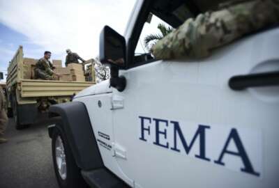
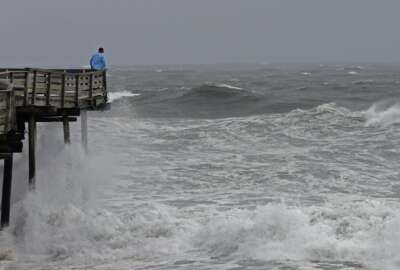
Natural disasters are an all-hands-on-deck situation for the federal government. The Federal Emergency Management Agency is the most familiar federal player in the drama of disaster response, but other federal agencies from the U.S. Coast Guard to the Agriculture Department to the U.S. Geological Survey are pitching in to the effort to respond to hurricane Florence, and other natural disasters.
Watch out, America! #HurricaneFlorence is so enormous, we could only capture her with a super wide-angle lens from the @Space_Station, 400 km directly above the eye. Get prepared on the East Coast, this is a no-kidding nightmare coming for you. #Horizons pic.twitter.com/ovZozsncfh
— Alexander Gerst (@Astro_Alex) September 12, 2018
USCG
“We’re ready to support FEMA, and we’re ready to support the impacted states,” said Rear Adm. Scott Buschman, USCG’s Atlantic area commander. “For Florence, we are pre-positioning our people to be able to respond as quickly as possible. We’re setting up incident management. We have thousands of people engaged in Hurricane Florence preparations so they’re able to respond. We’ve surged people in from different parts of the Coast Guard. We’ve surged in aircraft, we’ve surged in boats and other equipment.”
Buschman said the added personnel include elements of the 6,000-strong USCG Reserve that have been recalled. USCG also has a volunteer auxiliary force of 20,000 that it can draw upon to supplement.
Materials that have been prepositioned include mobile communications vehicles and towers for an offshore command and control emergency alert system called Rescue 21, which allows boaters to send an automated distress call that includes their location.
“Experience in the past tells us that storms will have impacts on communications equipment and infrastructure,” Buschman said. “Recent experience tells us that we may experience challenges to both radio and cellular communications. But we look at ways to mitigate that. One way to mitigate that is to preposition our resources so we can restore communications as quickly as possible.”
One method of communication that USCG is not focused on is social media. Despite reports that it was used to good effect in Houston during Hurricane Harvey, Buschman said it’s not something people should rely on in an emergency.
“People do use social media during disasters,” he said. “But there are some challenges with doing this. Someone may not be monitoring it. There’s certainly not enough resources to monitor all social media that is out there. We urge people to use existing emergency systems.”
USDA
Meanwhile, USDA is making it easier for federal agencies to reach people in areas affected by specific events. It’s developed a tool based on Geographic Information Systems (GIS) that projects news outlets and their audiences on a map.
“The tools that we have are largely limited to, basically, it’s a spreadsheet-type search, where you’re limited to searching by city or state,” said Dirk Fillpot, communications coordinator at USDA. “To pick a rather topical issue, or timely, with the hurricane cone. As you’re dealing with Hurricane Florence coming in, with the tools that we have otherwise, generally the user would need to identify all of the cities that fall within the hurricane cone, and search for all the media outlets that fall within that area, as well as the cities that may fall outside the hurricane cone but may provide news coverage into that area. Then they would have to pull the media list for each of those cities to actually have a distribution list. If they were to spend the time to do that, in order to accurately target the populations that are affected.”
So agency public affairs personnel have to work back and forth, cross referencing between several different documents in a time-consuming and tedious process. This new tool combines all the information carried by those documents into one.
It all works on GIS, which is basically a map that users can add layers to. So a hurricane forecast cone could be a layer. So could the habitat for the breed of mosquitos that carry a certain disease like Zika, communities within 10 miles of a prison break, a specific veteran population, the region affected by a fault line, and almost anything else that can be geographically plotted.
So with this system, a public affairs officer can bring up the map, trace the affected area, and the program would automatically create a distribution list of news outlets that serve that region.
“We think this is a rather unique tool,” Fillpot said. “It may be the only one of its kind.”
Fillpot said the tool was completed in May, and it’s being shared out to as many federal, state and local agencies and governments that are interested in using it.
Time-lapse video of a #NOAA WP-3D Hurricane Hunter (#NOAA42) flight into Hurricane #Florence on Sept. 10, 2018. Get the latest on the storm at https://t.co/MlZk25kG0d. Credit: Nick Underwood/NOAA pic.twitter.com/FQ3RJMKVUU
— NOAA Aircraft Operations Center (@NOAA_HurrHunter) September 11, 2018
USGS
When it comes to science, you’d probably associate hurricanes with meteorology and oceanography. Most people don’t consider the effects that storm has on the local geology through storm surge and erosion. USGS does.
USGS personnel spread out across the forecasted landfall area of major storms like Hurricane Florence, placing specialized sensors that allow them to track storm surge. According to its website, at least 205 of these sensors now span the Carolinas, Maryland, Virginia and West Virginia ahead of Florence’s landfall. The sensors collect readings such as height, water pressure and timing of a storm surge.
That helps USGS’ Coastal Change Storm Hazards Team predict the damage that will be caused by storm surge. For example, they expect the surge from Florence to completely cover one-quarter of the dunes in North Carolina, and one-fifth in South Carolina.
Copyright © 2024 Federal News Network. All rights reserved. This website is not intended for users located within the European Economic Area.
Daisy Thornton is Federal News Network’s digital managing editor. In addition to her editing responsibilities, she covers federal management, workforce and technology issues. She is also the commentary editor; email her your letters to the editor and pitches for contributed bylines.
Follow @dthorntonWFED


