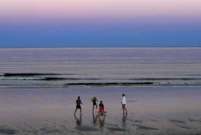
Two agencies launch a joint challenge involving data, climate decision applications
The National Oceanic and Atmospheric Administration, together with the Census Bureau, recently launched a challenge. They're looking for developers to find crea...
Best listening experience is on Chrome, Firefox or Safari. Subscribe to Federal Drive’s daily audio interviews on Apple Podcasts or PodcastOne.
The National Oceanic and Atmospheric Administration, together with the Census Bureau, recently launched a challenge. They’re looking for developers to find creative ways to use NOAA’s data. The goal is to create applications state and local governments can use to make better decisions about climate change. Joining the Federal Drive with Tom Temin with more, the chief of NOAA’s communication, education and engagement division, David Herring.
Interview transcripts:
Tom Temin: Mr. Herring, good to have you on.
David Herring: Thank you, Tom. It’s a pleasure to be here with you today.
Tom Temin: Now, tell us what Census brings to this, what NOAA brings to this, and basically what it is that’s going on here? And what’s the status of the program right now?
David Herring: Yes, thank you. This is part of the Opportunity Project, which is an annual developmental sprint hosted by the Census Bureau, aimed at making available federal agencies’ data for use by commercial companies in their own applications. So the idea is to help people get and use federal agencies data in a wide range of applications.
Tom Temin: And NOAA probably has the most data on climate and atmosphere and so on of anyone. But is it strictly known as data that is available to challenge takers? Or do you bring in, I don’t know, Agriculture Department and NASA? So many agencies have allied data here.
David Herring: So it’s true that NOAA does serve as the nation’s archivist and steward of weather and climate data, not just from all across the nation, but from around the world. However, the Opportunity Project is inclusive of agencies from all across the federal family. So in this particular sprint, we are including data from the US Geological Survey, from NASA, from EPA, from FEMA, and other agencies.
Tom Temin: We have EPA too, forgot about them for a minute. And how does this work – can anyone join the challenge and download data sets or do you pick and choose from among proposals to let people go to the next phase and actually start coding things.
David Herring: So there are actually two initiatives as a part of the opportunity project underway. In the first one, there was a recruitment process, whereby different companies, technical teams, could offer to lead teams. So we have in our sprint, we have six current technical teams that are working on their own solutions. And of course, they will retain the intellectual property rights, and they’ll be able to take their own products back and find pathways to taking them to market for themselves. And then there’s also an open data for good challenge that anyone, anywhere in the world that follows that same process that the Census Bureau hosts can jump in and participate in, and there are cash prizes awarded for the winners of those competitions.
Tom Temin: And give us an example of the types of teams or the types of organizations that are fielding teams in this. Are they coming from Exxon Mobil or are they coming from Greenpeace, or the range of people that have something to say that impinges on climate?
David Herring: There are both large and small companies that are participating, and they have teams. So for example, Esri, the very well known mapping technology company based in California There’s also Deloitte, that’s also very well known. But then smaller, perhaps less well known companies, such as Mapbox, City Ventures, My Sidewalk. There are a number of smaller mapping companies and application development companies that are participating. So it’s really open to all.
Tom Temin: All right. We’re speaking to David Herring. He’s the chief of the communication, education and engagement division at the National Oceanic and Atmospheric Administration. And what’s your conception of what types of applications might come out of this? Say there’s a town manager or a city council or a governor’s council on climate – I mean, these kinds of initiatives are happening almost everywhere you look now – but what do you envision could be a typical type of outcome that would be useful to a non-federal governmental entity?
David Herring: We’re seeking the development of new computer technologies that are going to make it quicker and easier for local communities to find and use federal agencies data, and to integrate these data together with their own local data and information to help them build their knowledge together, and ultimately, to help guide and form their local resilience planning. Some feedback that we’ve received over the years tells us that often these local community leaders or the consultants they hire sometimes are challenged in finding what’s available to them. Or perhaps they’re challenged and understanding what the data mean, or the formatting may be challenging for them. So they’re issues that they’ve been struggling with. So the idea here is to build what I like to call is the technological bridges as well as the cognitive bridges that are needed to enable these local community leaders to find our data and integrate them seamlessly together with their own local data to better inform their planning process.
Tom Temin: And what about the big civil engineering firms? Often they act as consultancies to non-federal government in planning roads and planning dams and in planning all sorts of infrastructure. And so resilience clearly, as we’ve seen in recent weeks, has to be part of that whole development. Do you find those companies also interested in this challenge?
David Herring: Yes. Often when there’s the planning process that’s happening in a location, there are actually multiple entities together in the room sitting around the table, participating in what I like to call a co-production of knowledge process. And each is bringing their special expertise to the table. And it’s a multifaceted deliberation. But often, these architecture and engineering companies, they’re bringing their own expertise, they have their own data, but they are also seeking information from both the federal family in terms of climatic changes, as well as environmental circumstances and changes that are ongoing, but they’re also seeking local communities, socioeconomic data and information as well. So it’s a bit of a mash up of data and information and expertise from multiple sources in a deliberative dialogue.
Tom Temin: So therefore, Census, which is the enabler, is almost the program manager of the challenge, could also have a lot of the data that would be needed to complete some of this work, because where water might be or fire might be, they would know, Census would know where people might be to overlay on that other information.
David Herring: That’s right. So what populations are living and working in what locations, and also what about our built environments, our infrastructure, and our valuable natural resources. So that information is also coming from other agencies. So it’s really one of those. And not only whole of government initiatives, but it’s a whole of society initiative, because none of us knows as much as all of us. And it really is an exercise in knowledge sharing, gathering and integrating information in a sort of a facilitated dialogue process. Putting all the pieces together to help us understand our risk, and to help us determine together what to do about it.
Tom Temin: Now, with respect to the federal data itself, you mentioned five or six big agencies that are involved here. And there’s probably more and, frankly, hunting for data sets that are relevant among federal agencies, that’s a full time job, it’s like spelunking, almost to be able to find it. And then lord knows what format it will be when you finally do find it. So is there anything going on in the back end to try to stage and organize and apply metadata and so forth, so that the researchers spend their time thinking about the application and not hunting for the federal data that might be relevant?
David Herring: Well, yes, Tom, that’s exactly right. There’s a lot of elbow grease now going into making improvements in the descriptive information. The word metadata, which is data about data. So in short, what does this data mean? How can we convey that in plain English, recognizing that the user communities out there that also want to get and use these data may not be experts, they may not be researchers or scientists, but rather they may be responsible for infrastructure, or land zoning, or community health, and so forth. And so again, that’s why I use that word bridge building, it’s both the cognitive bridges as well as the technological bridges, they may also not be data experts, they may not know how to format or how to analyze and process data. And so doing a lot of pre-processing or applying different services that make it really easy to grab and integrate our data together with their own so that they can begin to get right into the deliberation. So it’s just making the whole thing a lot faster, more efficient, lower cost.
Tom Temin: Because to use the data for an application doesn’t mean you necessarily have to download it. And once you have a runtime application running, it would have to be able to access the data, but again, not own that whole or take in that whole data set. So who’s responsible for the APIs here? Does NOAA, for example, have a library of APIs to the data sets or do the developers have to develop those themselves also?
David Herring: Well, that’s a great question. And again, that’s one of the situations where I like to say it’s an all of government, all of society approach. So certainly through the federal geographic data committee, or the FGDC. Many of the agencies and the federal family have been developing and sharing these APIs that allow people to sort of develop their own customized tools for integration of maps and data from across the federal government. But a lot of the consultants and or these A&E firms will develop some of their own APIs as well. So it’s a situation where sort of both parties are reaching across the divide and coming together to increasingly make this more seamless.
Tom Temin: And what are some of the deadlines and milestones at this point?
David Herring: Some of the deadlines, we kicked off the sprint on August 5, and it’s a 12-week developmental sprint. And so in the first couple of phases, we have been bringing together the developers with the target user communities and facilitating an interview process where they come to understand them better in their workflow. We’ve introduced them to a listing of datasets that we think are relevant for local resilience planning to help socialize the data and help them understand. And so our next milestone that’s upcoming is really their concept pitch. So how are they going to put all these puzzle pieces together into some new technology, some new API or some new application that’s going to support these local community planners and their consultants. And then beyond that, we’ll start to have discussions about, okay, what would be pathways for taking these products to market?
Tom Temin: And one of the premises behind the challenge is the development of equitable resilience building – and what exactly does that mean?
David Herring: Good question. Equitable resilience building ensures that disadvantaged, underserved elderly, and communities of color, really those who are hit first and worst by the impacts of climate change, are not emitted from the resilience building process. There’s a saying that I like that goes nothing about me without me. And so the point is, we cannot achieve climate resilience unless we center diversity, equity and inclusion, really throughout the resilience planning and building process. And because every local community situation is unique, both in terms of their values and in terms of their exposure to climate related hazards, every segment of the community must have a seat at the table in deciding what actions to take to promote the health and vitality of their whole community while reducing the risks.
Tom Temin: Alright, sounds exciting. David Herring is the chief of the communication, education and engagement division at the National Oceanic and Atmospheric Administration. Thanks so much for joining me.
David Herring: Thank you. It’s been a pleasure.
Copyright © 2024 Federal News Network. All rights reserved. This website is not intended for users located within the European Economic Area.


Tom Temin
Tom Temin is host of the Federal Drive and has been providing insight on federal technology and management issues for more than 30 years.
Follow @tteminWFED