Did you even know the government has a National Ice Center?
The U.S. National Ice Center. It sounds like a hockey rink. But actually it's an agency, operating under the Naval Meteorology and Oceanography Command.
Best listening experience is on Chrome, Firefox or Safari. Subscribe to Federal Drive’s daily audio interviews on Apple Podcasts or PodcastOne.
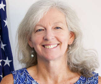
The U.S. National Ice Center. It sounds like a hockey rink. But actually it’s an agency, operating under the Naval Meteorology and Oceanography Command. Actually a collaboration of several agencies: the Navy, the National Oceanic and Atmospheric Administration, and the Coast Guard. To find out more about the National Ice Center, the Federal Drive with Tom Temin spoke, in studio, with the center’s director and commanding officer, Navy Commander Casey Gon.
Interview transcript:
Tom Temin: What exactly is the mission of the U.S. National Ice Center?
Casey Gon: You did a great job explaining who we are. We are tri-agency organization that is NOAA, the Coast Guard and the Navy. We are an operational center that keeps people safe that are operating in, on or near the ice.
Tom Temin: And just reading a recent news release on your website, I saw that a piece of ice head calved, I guess that means break off and float away. So icebergs and floating ice, even this far into the 21st century still matter to ships and navigation?
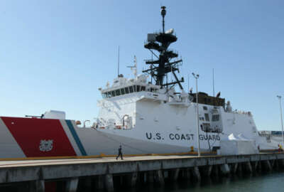
Casey Gon: Yes, sir. Absolutely. So we track the huge icebergs that calve off the Antarctic glaciers in the Southern Hemisphere. And we actually track them, name them and monitor those. For the Northern Hemisphere, there’s a smaller command called the International Ice patrol, which is a Coast Guard command that’s co located in Suitland, Maryland, with us at the federal complex. And they actually track the iceberg center in the Arctic shipping lanes that were borne out of the Titanic incident, actually.
Tom Temin: Sure. Yeah. And golly, which still reverberates I think throughout shipping and though the kind of the national consciousness all these years later. Just out of curiosity when a iceberg calves and floats away as its own entity, how long does it last? What happens to icebergs over time?
Casey Gon: We track them and they float away. And over time, they’ll go away and just—
Tom Temin: Disappear?
Casey Gon: Disappear. Yep.
Tom Temin: All right. So with the Coast Guard, leading the agency in the Northern Hemisphere, and you looking at the Southern Hemisphere, there’s really no interaction in terms of icebergs then, is there?
Casey Gon: Not necessarily interaction from the two agencies. But really where the National Ice Center is focused is actually tracking the ice. So we look at the Arctic ice, we look at the Antarctic ice. And then we also look at ice on the Great Lakes, the Chesapeake Bay, the Delaware Bay, and then wherever else there might be ice that the Navy might be interested in. So clearly, given the current geopolitical situation, we’ll be looking to see if there’s any ice and things like that going on in the Black Sea, and how that might affect operations.
Tom Temin: Right, because Russian forces are in pretty cold climates where they keep their ships in their subs. So you’d want to know what they might be encountering?
Casey Gon: That’s absolutely part of it. And when you look at the way our organization is broken down, we identify as the National Ice Center, but we all have our specific missions, if you will. So the Navy is worried about ice from where our submarines are going, and where our gray hull ships are going. The Coast Guard has the only two icebreakers in the U.S. inventory currently. So those icebreakers are constantly. In fact, the Coast Guard Cutter Healy is just wrapping up its summer patrol, where they went all the way up to the North Pole and back. My operations officer was on board providing support on the best way to go about navigating through the ice to achieve those mission goals. And then the Polar Star is the other one that typically goes down to McMurdo Station for the annual resupply to McMurdo Station in the Southern Hemisphere, which we also support. And then NOAA’s view on ice is to track it climatologically. And they also have operational missions on the Great Lakes. So a ton of commerce is moving on the Great Lakes. And so there’s an icebreaking mission on the Great Lakes to keep those lanes open so commerce can continue throughout the winter months. Additionally, with the Alaska Sea Ice Program, that’s also a NOAA mission based in Alaska, where they’re looking at ice with a totally different perspective of how is that affecting the Inuit cultures up there for hunting, fishing and maintaining their lifestyle? So the National Ice Center is a really interesting thing because you have this Naval mission piece, you have this humanitarian type mission, and then this commerce mission, and they all come together and we help manage that.
Tom Temin: And what sorts of assets do you have to look at ice? NOAA, of course, has its satellites. And it also has ships and submarines. And the Navy has the whole Meteorology and Oceanography Command. So are there special assets devoted to just the U.S. National Ice Center for looking at these things and tracking them and finding out where they are?
Casey Gon: The number one workhorse that we rely on is satellites. Specifically, we really like synthetic aperture radar satellites. And the reason we like that is because they’re all-weather, they can see through the clouds they can see during the day they can see during the night. We also have access to visible imagery that is affected by clouds and nighttime microwave imagery, and we’re constantly looking and working with the scientific communities for new options and new opportunities, whether it’s a different band of synthetic aperture radar and how we can exploit that, as well as we invest heavily in what’s called the Interagency Arctic Buoy Program where we actually buy buoys, and they’re deployed through ships, as well as aircraft to collect what we call insitu observations. And then finally, this year, which we’re really excited about is we signed what’s called a special CREDA or a cooperative research and development agreement with industry, a company called Sofar, who’s making movies. And a part of the mission when the Coast Guard Cutter Healy went up to North Pole was to put these basketball sized hardened buoys in the Arctic to see how they would perform. So we dropped five of those buoys there, and we’re going to drop 10 buoys in the Southern Ocean on the deployment for the Polar Star.
Tom Temin: And by the way, are they marked in some way so that some other nation might not mistake them for mines?
Casey Gon: They’re bright yellow, and they have solar panels on him.
Tom Temin: No one would mistake that for a mine?
Casey Gon: I don’t think so.
Tom Temin: We’re speaking with Navy Commander Casey Gon, he’s commanding officer of the U.S. National Ice Center. And tell us about the personnel makeup and what kinds of skills you have, and the balance between civilians and uniform members.
Casey Gon: I have a small but mighty team, we have approximately 50 people on board. And our makeup is about 10 military in uniform. So we have some senior enlisted personnel who help run our IT and do administrative work, as well as my department heads are lieutenants in the Navy. And then we go into the Department of the Navy has actual physical scientists and meteorological technicians who are actually doing the analysis day in and day out and they’re civilian DON employees. They man our watch floor, and they literally draw the line on where the marginalized zone is in the Arctic and Antarctic. And then what’s closer to my heart is we actually get an opportunity to work with customers that are going up there, and we learn and understand their mission. And then we figure out how we can tailor those products to specifically support their mission, be it for voyage planning, we don’t want to come near the ice. So keep us away, 100 miles away from the ice edge. How do we do that? And we figure out how to communicate those products visually or in text or whatever their bandwidth limitations are, we try to manipulate that so we can get the information to them so they’re safe.
Tom Temin: So one way or another, your output is telling people where ice is and where it could be moving?
Casey Gon: Yes, sir. And then we have on the NOAA side, some NOAA employees, the deputy director, Mr. Kevin Berberich, is a NOAA employee. He is the director of the Ice Services Branch, which falls under the Ocean Prediction Center in NOAA. And then we have a product area lead, Mr. Walt Clark. And then we have a very small but mighty contracting team that does all the snow and ice mapping around the world. And that’s a contractor team that is through NOAA. And then I have my IT team, my IT specialist is all Navy right now. They’re all civilian with the exception of one enlisted Navy member. And that IT team is mighty because they’re coding. And they’re figuring out how to make a very complex system so multiple people can look at different regions of the world and draw these lines so we can get the information out to communicate that and they’re maintaining our websites. And again, in that IT team is only five people strong, supporting this, and we’re the only ice center in the world that is mapping ice globally. So when you think about Britain, or Argentina, or Canada, they have their own ice services, as well. But they’re really concerned about their geographic region that’s important to them, where they’re operating or what affects the country. What makes the U.S. unique and very special is our ice center actually maps it globally. So we look at the entire Arctic, the entire Antarctic, and we track that. And so it’s very important as you’re looking at the climatological record of how the ice is growing or receding and how it’s changing over the years. We’re that climatological record, we’re providing that record, globally, which is unique.
Tom Temin: Now the iceberg that sank the Titanic took a Captain Smith by surprise, there were reports but no one knew precisely where it was, and he was going a full 20 some knots, do you have tools nowadays that can maybe predict where an iceberg might calve and where it might head once it does break off?
Casey Gon: Forecasting these events is an active area that’s growing of research in science. What I can offer is Cmdr. Marcus Hirschberg, the commanding officer of the International Ice Patrol. His team in the Coast Guard is investing heavily in artificial intelligence machine learning algorithms to identify these icebergs and then once they’re identified, trying to model where we think they’re gonna go, obviously, it’s a very difficult problem. His old XO had a really great presentation that he would give that the difficulty in this algorithm is, a lot of these icebergs are about the same size as a ship. So it’s a satellite image that’s pixelated. And somehow that computer algorithm has to decide, is that a ship? Or is that an iceberg? And he would actually play a game with us throwing up pictures and say, is that a ship? Or is that an iceberg? And it’s incredibly difficult. And it’s a problem that’s being actively looked at and figured out.
Tom Temin: There’s no way you can kind of fly over the ice and sea a certain shimmer and say, “Oh, that’s about to be an iceberg.” Capable of that yet?
Casey Gon: I think we can do that. But the problem that you just identified there for me, and if Cmdr. Hirschberg was here is the flying over peace, assets are limited, they’re very remote, austere locations to get to so the legs on airplanes are limited to do that. And it’s incredibly expensive. In fact, that’s why the ice patrol is looking at taking this shift and trying to take advantage more of satellite imagery, because aircraft time is so expensive and so hard to come by to do this mission. So they’re actually kind of going through a transition themselves on how to do this. So we’re really relying on satellites. And so the question that I kind of bounced around in my head with respect to this, just from an ice perspective, and in addition to the icebergs, is what other technologies out there are there cheaper satellite constellations that are maybe less expensive, but we can throw more of out there. So we can get pictures faster back to the operators to look at these things and analyze them. On average, there’s times where we don’t get any pictures to look at, for specific areas, because the satellite just didn’t fly over that. So if we can have more satellites in the sky, to take more pictures and get them back to us faster, and cut down on that latency that I think we could probably do a better job. And I think there’s a lot of good industry initiatives out there that are getting after this for multiple reasons.
Tom Temin: Basically, you have to keep watching the edge of the ice, though, correct?
Casey Gon: Absolutely. I mean, the ice, it’s dynamic, it changes. The weather events that occur in the high latitudes are incredibly dynamic. And you know, that ice edge can grow or shrink overnight, you know, on the order of hundreds of miles. And so that’s why what my team does is so important. So if you think about having a Navy vessel operating up there, that’s not ice hardened, and not designed to be in the ice, and they say, “Hey, keep us 100 miles away from the edge of the ice. We’re comfortable with that.” Well, we know that the ice can shrink or grow by 100 miles overnight, literally, that’s problematic. And that could create a very dynamic scenario for the Coast Guard cutters, or the Navy ships that can’t handle those conditions.
Tom Temin: Sounds like maybe you need one of those long lasting drones with a camera that could fly the whole perimeter. And then, you know, launch again, free idea for you.
Casey Gon: I think it’s interesting. And industry is doing an incredible job with looking at how they can get after these reasons. Obviously, from a Navy perspective, we would be very interested in and having that persistence. But we’re happy to work with industry, we’re happy to hear the ideas and see how we can get after these things. But it’s larger than that science is interested in this area. Climate change is a very active area of research. The current administration is very concerned about climate change and what they can do about it. So it’s a really ripe, awesome opportunity right now to take advantage of potential advances in technology and science.
Tom Temin: And just a quick question about your own background. Are you a meteorologist, an ice expert? How did you come to this particular perch in the Navy?
Casey Gon: Yeah, it’s a funny story. But I started off driving ships in the Navy. I was a surface warfare officer for approximately six years. And then I transitioned to become a meteorology and oceanography officer. So, I am now meteorologist oceanographer for the Navy. I had the opportunity to go to the Naval Postgraduate School twice to get my master’s degree and ultimately, my PhD in nearshore oceanography. And I’ve had the opportunity to serve in a variety of roles in the community, whether it was on board a ship as the oceanographer or in Bahrain as the fleet oceanographer, or now currently, in my role as the commanding officer and director of the National Naval Ice Center. Am I an ice expert? Absolutely not. I have an incredible team of ice experts that I lean on heavily. But I am a meteorologist. And I am an oceanographer. So I understand environmental science pretty well. One thing about ice, though, is it’s a very niche area. So my team is truly their national treasures, right? Because there’s only one National Ice Center and those 12 to 15 analysts at any given time, there are some of the only people that do this in the world. It’s a small community. So it’s pretty important and we’re really lucky to have the people we have.
Tom Temin: Navy Commander Casey Gon, his commanding officer of the U.S. National Ice Center. Thanks so much for joining me.
Casey Gon: Thank you.
Copyright © 2024 Federal News Network. All rights reserved. This website is not intended for users located within the European Economic Area.


Tom Temin
Tom Temin is host of the Federal Drive and has been providing insight on federal technology and management issues for more than 30 years.
Follow @tteminWFED
Related Stories
Getty Images/iStockphoto/Chainarong Prasertthai