The State Department launches a special program to monitor the violence in Sudan
The Federal Drive with Tom Temin recently brought you an interview with one of this year's Data for Diplomacy awardees from the State Department.
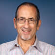
The Federal Drive with Tom Temin recently brought you an interview with one of this year’s Data for Diplomacy awardees from the State Department. The award cited the Bureau of Conflict and Stabilization Operations for its work in a program called the Conflict Observatory. Team lead Susan Wolfinbarger joins Federal Drive with Tom Temin once again for an update on a new observation post in the deeply troubled Sudan.
Interview Transcript:
Susan Wolfinbarger Sure, the conflict observatory program is a way that we are harnessing remote data feeds and technologies to monitor crisis situations around the world. We’re taking advantage of things like commercial satellite imagery and other open source information that’s available globally and can help us understand events on the ground.
Tom Temin So what are some of the types of feeds that might be helpful in Sudan right now?
Susan Wolfinbarger We’re taking advantage of a lot of new data feeds in Sudan. For example, we’re using a lot of high resolution satellite imagery to monitor events on the ground. We’re also using thermal imagery, because a lot of conflict events also produce heat signatures. And so thermal detections can actually give us a lot of ideas about where we should be looking. For example, with the burning events that have been in the news in Darfur. It helps us quickly triage large areas and figure out where we should be looking.
Tom Temin And this civil war has produced refugees and large numbers of people on movement. Are you able to have feeds, drone pictures or some means of tracking what’s going on on that front?
Susan Wolfinbarger We’re also using data source called human mobility data, and that really helps us understand some of those more fine grained movements of population. So this is using location data from cell phones, and it’s helping us to understand the population shifts that are happening on the ground, which can be really helpful for responding and assisting in humanitarian operations, because we have much more detailed information about where people have left and where they have gone to.
Tom Temin Right. So just a side question. In some nations they can maybe block those signals or turn off the cell towers in this kind of thing. So is that been the case in the Sudan Observatory? Or has it been pretty much an even data flow?
Susan Wolfinbarger There are Internet outages and things that are happening on the ground across Sudan that does impact the timeliness of the data in some cases. But what happens with this feed is that even when a device does not currently have Internet access, it stores the information and then is able to transmit it once it regains a signal. So sometimes there is a delay on that information, but we’re still getting it significantly more quickly than we could in any other mechanism.
Tom Temin And are there unstructured sources of data that also feed into the observatory, for example, news accounts, which are text or human observation that is reporting in to people at the State Department or maybe coming through military reports?
Susan Wolfinbarger Yes, absolutely. A big component of the work in Sudan is using open source investigation techniques. So these are really developed methods for monitoring all of the information that is posted on the Internet, because there’s so much that’s shared on social media, on chat platforms. Even statements by officials are part of what is collected. And so as they come across photos and videos that are found online, you can actually geo locate those using these techniques where you identify key aspects of that photo or video and tie it to known locations and satellite imagery. So that helps them get views of what’s going on the ground that you wouldn’t be able to get from just a satellite image alone.
Tom Temin And what about the technology aspects of it? I mean, you are a technical person or a diplomatic person or you bridge those two things, because it sounds like there has to be some really good technical underpinnings from the IT staff to be able to enable these observatories.
Susan Wolfinbarger I’m actually a geographer by training and my specialization is in remote sensing. So doing the type of analysis that the teams are doing as part of the conflict observatory. But I do work at the State Department, and so I’m figuring out how we can really leverage all of these analytic techniques, all these data feeds, and bringing them in to support the goals of the State Department and our work in the diplomatic realm.
Tom Temin We’re speaking with Susan Wolfinbarger. She’s a team lead in the Bureau of Conflict and Stabilization Operations at the State Department. And I can understand why you got an award for Data for Diplomacy and all of this effort. These feeds come in, then what happens? How are they integrated? How are they turned into products? You can’t put them in a pouch and seal it with wax.
Susan Wolfinbarger So we have a analytic platform that we’re using for the conflict observatory. And this platform is where we ingest all of the data feeds. And then all the teams that are part of the Conflict Observatory, including the Yale Humanitarian Research Lab, Planetscape AI and Esri, are then doing their research and documentation activities on that platform, and that’s a really secure FISMA high system. It’s a very secure way of doing all of the analysis and being able to decide what information is shared publicly and what isn’t. Because as you can imagine, doing this type of an analysis of a war zone creates some sensitive information.
Tom Temin And earlier we spoke about the work of the observatory in Ukraine did learnings there somehow inform the set up of the observatory, the newest one in Sudan?
Susan Wolfinbarger Absolutely. All of the data feeds that we’re using in the platform itself are available to be used anywhere in the world. And so when we started discussing a Sudan conflict observatory, it was really easy, relatively speaking, to add that component to the work, because we have experienced analysts, we have all of the global data feeds that we needed and we just need to bring them together and point them at Sudan.
Tom Temin And other components of the government do data gathering and geo location work. There’s the National Geospatial Intelligence Agency, which has the really big view. But then there might be military assets, even though we’re not involved as much in the Sudan militarily, but maybe observing what’s going on. Is there a chance to get feeds from other sources outside of the State Department and vice versa? Can your feeds maybe help the military if they request that feed.
Susan Wolfinbarger All the information that the teams are using to create their documentation is completely unclassified and open source or commercial information, and they’re making that publicly available so that anyone can access it on their website.
Tom Temin All right. Sounds like the answer is no in that in that case. And who are the consumers of this within the State Department? And who do you sense might be using this open source data, maybe outside the State Department, academics, perhaps, or whomever?
Susan Wolfinbarger One of the biggest focus areas of this program is support to humanitarian operations. And so the teams are partnering directly with groups that are planning aid deliveries and other actions on the ground in Sudan. So there’s real time geographic data that they’re analyzing and producing analysis of is really critical in being able to provide a real time awareness of what’s happening on the ground as people are thinking about operating and making movements across Sudan.
Tom Temin So it might inform someone like, say, a contractor for USAID that could be operating there, knowing where it’s safe to go or where they can’t go or otherwise being able to adjust their plans. Would that be a use case?
Susan Wolfinbarger I think one of the best use cases is thinking about humanitarian convoys. So when you are trying to plan a movement from maybe Port Sudan to another location, being able to understand where there are checkpoints or where roads might be destroyed or a bridge might be out is really critical information. And so this information that’s being shared out and created by the team can really help in any groups that are working on that type of operations on the ground.
Tom Temin And a final question, how permanent are these observatories, these data collection sets that are then analyzed and and combined and so forth? Do you shut them off at some point? Or what’s the long term plan for each of the observatories? You’ve got a couple of them up and running now.
Susan Wolfinbarger Yeah, I think that the different observatories have different time periods associated with them. For example, in Ukraine, where we’re doing war crimes documentation, the justice and accountability processes that those are trying to assist can last for 10 or 15 years. And so we have to think about storing that information and making it accessible for a much longer time period than what we might in a more rapidly evolving, humanitarian focused type of operation that we’re supporting in Sudan. So it’s really about the end goal of the program and what we’re trying to achieve.
Tom Temin And I imagine a long base of observation, maybe after the conclusion of a conflict or the recession of it, let’s say, that itself could be a good analytical tool to compare what was going on in the heat of it versus what was going on in the tail of it.
Susan Wolfinbarger Absolutely. It’s always really helpful as we’re trying to understand what was happening in a conflict to have that type of information. It’s so unusual to have a way to create it. And so this documentation that we’re doing with the different conflict observatory programs is creating new information that people would not otherwise have access to. And that’s going to really inform a lot of our research and understanding in the longer term.
Tom Temin And do you have a dashboard in Foggy Bottom that you sit and kind of stare at all day?
Susan Wolfinbarger We have a lot of dashboards and they are really fun to interact with.
Copyright © 2025 Federal News Network. All rights reserved. This website is not intended for users located within the European Economic Area.
Tom Temin is host of the Federal Drive and has been providing insight on federal technology and management issues for more than 30 years.
Follow @tteminWFED


