Meet the Navy’s top oceanic and atmospheric expert
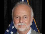
Rear Admiral Ron Piret, is commander of naval meteorology and oceanography, navigator of the Navy, and hydrographer of the Navy. He described the 2600 member...
Best listening experience is on Chrome, Firefox or Safari. Subscribe to Federal Drive’s daily audio interviews on Apple Podcasts or PodcastOne.
At the Sea, Air, Space conference this week, Federal Drive with Tom Temin caught up with R. Adm. Ron Piret, who is commander of naval meteorology and oceanography, navigator of the Navy, and hydrographer of the Navy. He described the 2,600 member operation that takes care of all of the Navy’s weather, oceanography and meteorology observations and analyses.
Interview transcript:
Ronald Piret: The sea is a challenging environment, no matter what you set sail on, or where you are from. Bottom line, the the environment and the sea get a vote. So certainly our first endeavor is that the fleet operate safely. But it’s more than that, it’s really taking our deep understanding of the environment, whether it’s in the ocean, in the acoustics, in ocean dynamics, or within the atmosphere and the electromagnetic spectrum, if you will, on how we then optimize and employ the fleet, regardless of platform. And that’s what we’re really about. Safety is the fundamental aspect, but we really build upon that it’s about fleet employment fleet lethality in the end.
Tom Temin: And you can understand how surface events and storms and the atmosphere are going to affect the surface of the ocean. Anyone that’s ever seen the ocean understands that, how far deep does that go? And how does it begin to affect submarine operations?
Ronald Piret: We, have a hashtag, if you will, really, it means it starts with us. And we really look to characterize the environment from the sea floor, the sea bed, all the way through the atmosphere to the stars. So one of the things we also do is we map the stars, that’s part of really understanding, positioning, navigation and timing, as well. So that’s another aspect of what we do, as well as just, weather forecasting and dynamics in the atmosphere, but also ocean dynamics. So when you’re thinking about things like anti-submarine warfare, you’re really talking about acoustics, how is sound moving through the ocean, and you really need to understand the ocean to understand that, frankly, but we have six survey ships that are forward deployed around the world where that our civilians meet up with in various locations, and will conduct those types of military surveys across the globe and areas of interest. And again, those are state of the art world-class platforms, where we are charting, and we are surveying the ocean floor. And then we obviously share that with the DoD broadly.
Tom Temin: And how do you interoperate say, with NOAA, which also has surface ships doing a lot of measurement? And for that matter, NASA is also doing surface of the Earth measurements and space measurements? There’s a lot of this gathering going on across civilian and DOD. How do you coordinate at all so you’re not going over the same ocean beds?
Ronald Piret: I really appreciate that question, because I do have one more title. And it’s the naval deputy to NOAA. So I actually work very closely with my NOAA counterparts, because we do have shared interests and atmospheric modeling and observation. So we share a lot of data. We also help each other deploy and recover our unmanned systems. And so we have a really great partnership that in terms of looking at, say things like hurricane intensity and hurricane modeling. And so the past three or four years, we’ve been collaboratively deploying ocean gliders to really measure the heat content in the Gulf, as well as the Atlantic so that we can then better model hurricane intensification. And that’s just one aspect of what we do with NOAA and the National Weather Service.
Tom Temin: Now, people have been measuring water, meteorological effects for centuries since since man put this up right, and stars. But my sense is that the data gathering and the amount of volume of data and the and the fine-grained nature of that data is really accelerating now, isn’t it?
Ronald Piret: Absolutely. With the advent and employment of unmanned systems and remote sensing, really, the amount of data that we can collect and ingest is just grown, really. And we are in fact, naval meteorology, and oceanography is in big data, we really, we ingest 40 plus million observations daily, we take that ingest that into our models, and then produce a forecast for the fleet. So we are in fact, we have a great relationship with the defense resource supercomputing center, as well. And so we really have a tight partnership, I’m sure they would like me to tell you that they’ve got the 53rd fastest computer in the world. So that’s what the the DoD and the nation are really putting towards the fleet, frankly, and ensuring that we’re getting the very best out of it.
Tom Temin: We’re speaking with Rear Admiral Ron Piret, commander of naval meteorology and oceanography, and what, together titled in your many jobs is hydrography. What is that? It’s drawing the water. That’s like a bucket. You draw water.
Ronald Piret: Really the science of hydrography and really mapping the ocean floor bathymetry. That’s, how we get to safety of navigation. And so those ships that we talked about our tag survey vessels are equipped with multibeam sonars that can measure the deepest part of the oceans as well as the shallowest and the littorals. And then we can turn that into boundary conditions, if you will, for oceanographic models for the dynamics and the acoustics as well.
Tom Temin: And to work as one of those 2600 people that you oversee, what skills do you look for? Sounds like a lot of math.
Ronald Piret: Absolutely. Certainly, we’re always looking for talented people whether to serve in uniform or in civil service from a science and technology, you know, engineering and mathematics. It ranges from physical scientists or oceanographers, geologists, we have the Navy’s only operational geology lab. We also folks who specialize in physics, optics, computer science, data management, the list goes on to include all types of engineering as well.
Tom Temin: And where is it all headquartered? Where all the big screens?
Ronald Piret: Well, we have a concentration, my command is headquartered at Stennis Space Center down there is the naval oceanographic office is down there, as well as the naval oceanography operations center is headquartered down there. We have fleet weather centers in the fleet concentration areas in San Diego and in Norfolk. And then we also have our supercomputing and modeling center, fleet, numerical, and meteorology and oceanography center in Monterey, California, as well. And last but not least, is the Naval Observatory, probably one of our oldest commands, that’s upon Observatory Circle, here in DC, that is chartered with positioning, navigation and timing, not only for the Navy, but for the Department of Defense as a whole.
Tom Temin: I reset my watch every time I drive by there on Massachusetts Avenue, the big clock. A couple of questions. You mentioned the ocean floor, how much left, is there still areas to be mapped and to be learned about?
Ronald Piret: There is plenty of work left to do. Frankly, if I told you a number, tomorrow it will be a little different. But you can safely say that having charted to current standards, the best standards, no more than 20%. We’ve got a lot of work to do in that area, and but we got a lot of partners across the world too. We’re also one of the member states in the International Hydrographic Organization that’s headquartered out of Monaco. And so we meet with regional experts to figure out what their requirements are, and how do we share data across those organizations and countries.
Tom Temin: And you mentioned you also map the stars. Anything left to learn from Star navigation in this day and age?
Ronald Piret: You bet, right? We certainly have all grown used to the utility of GPS. And as you stated, you did it on your phone this morning. Well, guess what? That time that we are a significant portion of national time feeds into that, that supports encryption that supports your Google Maps, you know, they got many people here to the conference today. And there’s still plenty to learn. We’re continually improving our accuracy and precision when it comes to time. Because that really does feed everything else we do, not only in our daily lives, really and in warfare.
Tom Temin: So in that sense, NASA and Space Force must also be interrelated enterprises, because they’ve got the look see you up there?
Ronald Piret: Well, we have partnerships, certainly with Space Force and NASA. But again, we do the charting of the stars on behalf of DOD. So we share that information and have a lot of interagency stakeholders.
Tom Temin: And by the way, do they still teach star navigation in the Navy?
Ronald Piret: Yes, they do. As a matter of fact, I think at one point in time, they thought, well, we got GPS, we have NASTAR, you know, we don’t need that anymore. But I think that we have found that there are ways to degrade that capability. So celestial navigation is alive and well in all aspects of warfare. So once we’re down here, and we’ll probably take a sight on the sun to make sure that we’re aligned.
Tom Temin: So long division and navigating by stars still good skills to have.
Ronald Piret: There’s no shortcut on the application of math. We’re all dealing with it.
Tom Temin: Rear Admiral Ron Piret is commander of naval meteorology and oceanography and I spoke with him at this week Sea, Air, Space conference at National Harbor.
Copyright © 2025 Federal News Network. All rights reserved. This website is not intended for users located within the European Economic Area.
Tom Temin is host of the Federal Drive and has been providing insight on federal technology and management issues for more than 30 years.
Follow @tteminWFED


