Hubbard Radio Washington DC, LLC. All rights reserved. This website is not intended for users located within the European Economic Area.
NOAA, Google teaming up to use satellite data, AI
Best listening experience is on Chrome, Firefox or Safari. Subscribe to Federal Drive’s daily audio interviews on Apple Podcasts or PodcastOne. The Nationa...
Best listening experience is on Chrome, Firefox or Safari. Subscribe to Federal Drive’s daily audio interviews on Apple Podcasts or PodcastOne.
The National Oceanic and Atmospheric Administration has signed on Google to help it find ways to make better use of the agency’s burgeoning satellite data. They’ll be using, you guessed it, artificial intelligence and machine learning in Google’s cloud. For how the agreement is set up and more about its goals, the Chief Information Officer for NOAA’s Satellite and Information Service, Irene Parker, joined the Federal Drive with Tom Temin.
Interview transcript:
Tom Temin: Miss Parker, good to have you on.
Irene Parker: Thank you. It’s nice to be on.
Tom Temin: And before we get into the details of the agreement, just give us a sense of the types and volumes of data that you’re dealing with. I know NOAA has a whole fleet of satellites up there.
Irene Parker: You’re right. So NOAA right now has both geostationary and polar satellites that we fly. And we also fly space weather missions. So right now we have approximately nine satellites that we currently own and operate, that we fly in both the geo- and polar orbits. We also partner with international partnerships, including [the European Organisation for the Exploitation of Meteorological Satellites (EUMETSAT), the Japanese Aerospace Exploration Agency (JAXA) and the Indian Space Research Organization (ISRO)] which is basically making sure that we have enough satellite data that covers our globe to make sure that we can appropriately forecasts the watches, and warnings.
Tom Temin: So there’s a lot of volume of data that’s constantly downloaded then correct? That’s correct. All right. And so what will this agreement do? What is it you’re trying to accomplish with the Google deal?
Irene Parker: Basically, this is a new type of agreement for NOAA. It’s the first other transactional authorities, sometimes called an OTA. And this is the first time NOAA has actually executed this type of contract. And basically, what this partnership is going to do with Google is it’s going to allow us to work with Google in a shared cost arrangement, where NOAA provides a certain amount of dollars, and Google provides a certain amount of dollars. And we both bring in our expertise, Google bringing in their AI and ML expertise, NOAA bringing in their scientific expertise on weather modeling, and coming together to see how we can improve our weather forecast model.
Tom Temin: Interesting because NOAA has supercomputing. And of course, Google has a pretty big cloud, from what I’ve heard with a lot of tools in it, will this be joint in terms of the technicals? That is will both both sides computer resources be brought to bear on this also?
Irene Parker: We will actually be using the commercial cloud on the Google platform, we won’t be using our on premise supercomputer capability. So this will fully be on the commercial cloud while we’re doing this partnership.
Tom Temin: The goal is better forecasting; is that a good way to put it?
Irene Parker: Yeah, so there’s basically four areas that we want to basically focus on it. One is in the data simulation area, which is definitely going to help in better forecasting. One is in simulation, which is also going to help in forecasting and prediction. Then, in parameterization, which is much more scientific. And then post processing, so the other types of products that are beneficial outside of weather forecasts. So in areas for climate, and things like that.
Tom Temin: And how does artificial intelligence come into play here?
Irene Parker: So the key thing that AI is going to bring to the table is that we have a significant amount of data as we had talked about previously. And right now, it’s difficult to exploit all that data with the current way our systems are set up. So what AI and ML is going to let us do is that we’re going to be able to exploit massive amounts of environmental data, and then allow us to hopefully get a more accurate depiction of the Earth’s environment when we use the AI and ML tools. So what Google brings to the table is certain tools like TensorFlow, which is going to be able to allow us to process the data a lot faster. And hopefully that will allow us to accelerate our research, for our products to go from research to operations using AI.
Tom Temin: We’re speaking with Irene Parker, she’s Chief Information Officer for the Satellite and Information Service at the National Oceanic and Atmospheric Administration. And is one of the goals to increase the accuracy of the days-out forecasts? Because the closer it is to now, the better the forecasts always are.
Irene Parker: Of course, those are always our goals. Right now, since the way that OTA works we’re still in our phase one planning phase, which is basically understanding what projects we want to work on. So we haven’t actually set all of our specific targets. But of course, that will always be one of our key missions.
Tom Temin: And I’m just curious about that supercomputer versus the Google Cloud question. Because if you need algorithms to run across huge data sets in a reasonable amount of time, are you saying then that the Google commercial cloud can do this in the same way that a supercomputer could?
Irene Parker: Well, that’s what’s going to be interesting. This will be the first time we’re actually testing out how we could use the commercial cloud to do this type of processing. I don’t know if it will be able to or if it will be better than on premise capabilities, but it will be one of the things that we want to see, is the scalability of the commercial cloud, which is scalable both vertical and horizontal, how does that work? When we are trying to do better data simulation.
Tom Temin: In many ways, supercomputers are simply largely scaled versions of standard parts. But beyond that, there’s also the architecture is different. Sometimes the instructions are different. So could it also be that some of the tools that Google will bring, like you mentioned TensorFlow and some of the other AI things, maybe those could also run in the supercomputer? That is flipping the problem on its side?
Irene Parker: I think it’s feasible. But until we actually start prototyping in the second phase of the OTA, all of these things are just right now hypotheses, and we’ve got to go and see what’s actually feasible and what’s not. And we have not done that yet at NOAA, and this is the first time we’re getting the opportunity to do that with using this OTA opportunity with Google. Usually, what we do is we design something, we go out and contract it out. This is an actual partnership, where we’re both learning from each other, and seeing what’s feasible and what’s not.
Tom Temin: And is there a particular premise that is a location where people can get together and work on these problems? I know, there’s social distancing and all that now. But what I mean is, is there like a program office, a place where people will go and have the sandbox together, that is NOAA and Google.
Irene Parker: So right now, like you said, it’s done virtually. But it is a cross-collaborative team between Google and NOAA subject matter experts that get together. The Google environment will be a NOAA, Google environment. And then folks will log in and jointly code together and hopefully come up with some amazing solutions.
Tom Temin: And will you be using data that is live, that’s being downloaded and fed into what is ultimately the National Weather Service products? Or do you have data sets that are fixed, and maybe from the past, to test out some of the concepts?
Irene Parker: We haven’t decided that yet. So we are still, like I said, in the planning phases, so we haven’t decided what data sets we need. And then if they need to be near-real-time, real-time, or our progressive data information.
Tom Temin: And just give us a sense of the timeline sounds like there’s a lot of decisions yet to be made. And you have just inked this. So now it’s pretty much in the planning stage sounds like.
Irene Parker: That’s correct. So there’s three phases to this OTA. The first phase is basically evaluating and consensus on the prototyping project, which is really key because this is an OTA in a partnership. So Google and NOAA have to come together and agree on the projects we want to work on. Then the second area is once we agree on phase one, we would go into phase two, where we would actually execute those projects and see the results. And then the third phase is that if those results are successful, we would actually go into a proof of concept mode to figure out how do we go to research operation pipeline. And associated with this, is this OTA is a three year contract, a three year OTA. So we have three years to execute this. However, we are working aggressively, to see how we can do this a lot quicker than the three years.
Tom Temin: And so far, are you getting early positive signs on how it will be to work with an outside partner in this what’s really an unprecedented way for NOAA?
Irene Parker: Very much so. It’s been extremely collaborative and productive in Phase One; the ideas have been flowing. And we are actually quickly working through and down selecting what areas we want to prototype. It’s been a pleasure working with the Google team.
Tom Temin: Yeah. And how many people from NOAA are involved roughly in this process?
Irene Parker: So it ebbs and flows. But right now we have about eight people working on it from the NOAA side. And they are a cross between NOAA scientists and NOAA IT experts.
Tom Temin: And when you work with the Google people, they’re the ones with the foosball tables, huh?
Irene Parker: If only we were there in person I would love to be playing foosball with them.
Tom Temin: All right. Irene Parker is Chief Information Officer for the satellite and Information Service at the National Oceanic and Atmospheric Administration. Thanks so much for joining me.
Irene Parker: Thank you for having me, Tom. I really appreciate your time.
Copyright © 2024 Federal News Network. All rights reserved. This website is not intended for users located within the European Economic Area.
Tom Temin
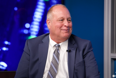
Tom Temin is host of the Federal Drive and has been providing insight on federal technology and management issues for more than 30 years.
Follow @tteminWFED
Related Stories
Protected: Cloud, AI and software-as-a-service form path to modernized HR
Related Stories
-
OMB’s new FedRAMP policy takes aim at the pain points Cloud Computing
-
Ready, set, run: Meeting users’ tech expectations and needs now Cloud Computing


