Hubbard Radio Washington DC, LLC. All rights reserved. This website is not intended for users located within the European Economic Area.
On Air: Federal News Network
Sponsored by Planet
How the Coast Guard’s satellite imaging plays a huge role in maritime domain awareness
Ret. Vice Adm. Peter Neffenger, the former vice commandant of the Coast Guard, said the maritime intelligence fusion centers improve what service members can se...
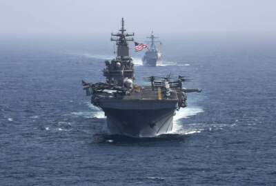
The Coast Guard is facing a more complex and varied mission as it protects the U.S. maritime borders, as well as possibly expanding into the Indo-Pacific region.
Adm. Linda Fagan, the commandant of the Coast Guard, said an increased presence in the Indo-Pacific region would require both more budget and a larger workforce.
“Until there’s budget support, we have the mission in the homeland. We play a critical role in homeland security, and there are many other regions in the world as well where we’re in demand. So there is for any organization always a tension point between the resources and capacity you actually have where that demand is,” Fagan said during a recent panel discussion with Maritime Security Dialogue hosted by the Center for Strategic and International Studies (CSIS). “We are fully engaged in the maritime border of the United States Customs and Border [Protection] as well. You don’t hear so much about it because the numbers aren’t as great. You talk thousands and thousands a day at the land border and then it’s tens and twenties, which is an order of magnitude difference between the land border and the sea border. The criticality in the maritime border approaches is really about life saving as people attempt these incredibly dangerous journeys by sea. It feels like everything’s fine and then it’s not. The chances of people losing their lives in these really dangerous crossings are much, much higher on the maritime side than they are on the land border side.”
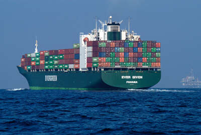
This is why the Coast Guard is relying more and more on satellite data from the automatic identification system (AIS), which provides specific information when monitoring vessels to assist situation awareness. Without additional budget or workforce capacity, the AIS will become more key to mission success.
Having AIS turned on is a daily routine for ships traveling, but some foreign vessels may not follow the laws requiring them to be on, leading to suspicious activity and the use of multi-source functions for the Coast Guard to identify the issue.
“There’s are a lot of reputable legal operators out there that use their automatic identification systems that notify people where they are and where they’re going to be,” Ret. Vice Adm. Peter Neffenger, the former vice commandant of the Coast Guard, said. “So part of what you’re able to do with a lot of these systems now, AIS being one of the primary, is you’re able to eliminate a lot of noise from the system so that you can begin to try to surface those so-called dark objects out there, those entities that aren’t abiding by the rules, that aren’t transmitting where their locations are or that are doing things that they shouldn’t be doing. And then you have to rely then upon all sorts of other means. So it is a multimedia; there’s open source information, there’s sensors that are on government operated aircraft. And there are, of course, national assets that can come to play in addition to commercial assets that are out there.”
Neffenger said there are maritime intelligence fusion centers that the Coast Guard operates as a multi-source function to accurately report what the service members cannot see from the ship. Satellite imagery is a main factor to report specific information.
“There’s certainly satellite imagery as a component of it. Signals intelligence is part of it. The sensor data coming off of aircraft, they’re overflying. CBP, for example, has overflight aircraft that are in the maritime domain,” Neffenger said on Federal Monthly Insights – Maritime Domain Awareness. “You’re getting imagery, primarily imagery. And it can be infrared imagery and just regular wide, broad-spectrum imagery that comes in. That’s picked up either incidentally as a function of what they’re doing on their patrol or sometimes it’s targeted.”
While having multi-source functions and satellite imagery as a tool in the Coast Guard, there are still challenges it faces when monitoring, such as following sanctions trade. This has been an issue for several decades and is still a global maritime domain awareness challenge. Another issue for the Coast Guard is capturing imagery and understanding what service members are looking at. The persistence of image over time is an important piece of imagery gathering.
“You want to understand the dynamics of what’s happening,” Neffenger said. “A single snapshot may show you a bunch of dots out there on the water, but it doesn’t tell you anything about what their intent might be.”
Neffenger said there are three components to gathering imagery: its visibility, identifying what you are looking at, and understanding it’s purpose.
“There are lots of different ways to get imagery. You can have direct clear camera type imagery, and take a picture, but you also have infrared imagery. There’s synthetic aperture radar imagery. It’s a combination of, hey, what’s our weather look like? What do we need to see? Where do we think we might have to take a look? And then what we have available, both open source commercial as well as national assets, and other assets that might help us to bring a bigger picture together of what we’re looking for,” Neffenger told the Federal Drive with Tom Temin.
The use of imagery gathering has improved over the years and is rapidly providing a large amount of data to assist the Coast Guard in maritime domain awareness.
“The government has purchasing agreements that allow us to purchase imagery from commercial providers. There’s so much good imagery coming out of commercial, open-source satellite data that, for purposes of what the Coast Guard does, it can be just as good as anything else that might be out there,” Neffenger said.
Copyright © 2024 Federal News Network. All rights reserved. This website is not intended for users located within the European Economic Area.

Derace Lauderdale
Derace Lauderdale is a digital editor at Federal News Network.