Hubbard Radio Washington DC, LLC. All rights reserved. This website is not intended for users located within the European Economic Area.
NGA looks to corral satellite imagery, other data in push for ‘synthetic persistence’
The agency wants to “know where everything is all the time,” in the words of one official.
The mapping agency for both the U.S. military and the intelligence community is increasingly turning to commercially available information as it looks to make data more accessible across its traditionally fragmented organization.
The agency wants to increase its sources for satellite imagery and other data to “know where everything is all the time,” in the words of one official.
The National Geospatial-Intelligence Agency’s new data strategy calls for managing data as a “strategic asset.” Vice Adm. Robert Sharp, director of NGA, called the growth in available geospatial intelligence from government and commercial sources “staggering,” saying it represents one of the agency’s major challenges.
“Kind of like the mountains Lewis and Clark had to scale, data is a mountain we have to climb,” Sharp said at the GEOINT 2021 Symposium in St. Louis, MO, last week.
NGA already rolled out a new “data governance framework” in late fiscal year 2020 and set up a governance council to better manage the vast array of digital information available to the agency, according to Deepak Kundal, chief data officer at NGA.
“We do not want to be in the business of pushing papers,” Kundal said in an interview. “We are actually making the calls on data in terms of lineage as to what needs to be done. How are we going to curate it? How are we going to present the data out to our customers?”
This year, NGA is planning to begin testing out the concept of using a “data lakehouse” to begin breaking down the walls between where data is managed at the agency, according to Kundal. NGA wants to catalog its data and make it available as a shared service.
“We want to slowly but surely import the data from these data silos to really help our artificial intelligence and machine learning algorithms go against that data,” Kundal said. “Artificial intelligence and machine learning is the new buzzword, but towards the end of the day, it is based on two most important factors, which is the quality of the data and the data quantity.”
NGA wants to use automation to speed up its analysis of overhead imagery, and Sharp said the agency plans to pair technology experts with mission analysts to develop “AI-enabled solutions.”
“The warfighters are challenging us to get machines to understand where that data needs to go, how fast it needs to go, what format it needs to be in, and driving it across the infrastructure, like a smart content delivery network,” Sharp said. “That’s where we need to go.”
He added the agency wants to deliver information derived from geospatial data in “single digit minutes, sensor to shooter or sensor to decision maker,” an allusion to NGA’s dual-mission of serving both the military and intelligence agencies.
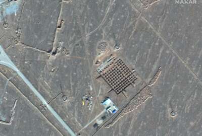
The primacy of data at NGA also comes as the agency increasingly turns to overhead imagery and other data derived by commercial companies, rather than largely relying on government satellites operated by the National Reconnaissance Office. The NRO is also looking to work more closely with commercial satellite firms.
Dennis Bowerman, director of analytic operations at NGA, said he wants to “interweave” commercial data with NRO-provided information.
“We need commercial imagery, commercial data, commercial services more than ever now in this environment,” Bowerman said during a panel discussion at the GEOINT Symposium “In my view, those elements of information need to provide the preponderance of the information that we’re bringing in.”
The push to integrate more commercial data into NGA’s analysis process will play a role in how the agency continuously track persons of interest and other developments around the globe, according to Bowerman.
“Having those commercial providers, in innovative ways, adding more information to what we know is going to help us to provide what I again call that synthetic persistence of being able to know where everything is all the time, from an analysis standpoint, as that allows us to derive pattern of life analysis so that we can understand what the adversary is doing,” he said.
One potential impediment to NGA’s adoption of more industry tools is differences in the types of data NGA provides, or as Kundal puts it, “the spatial nature of our data.”
“We are talking about data that is dealing in vectors, we are dealing in polygons, to really take a look at an image from a three dimensional perspective,” he said. “And really looking at the data from not only imagery, but the signal data that comes into us, there’s a full motion video element to it.”
He hopes companies, especially open-source providers, will come up to speed on NGA’s varying data requirements.
“Most of these companies, some do it portions of it well, but not one company does it all,” Kundal said. “So it’s got to be a combination of a lot of other vendors out here coming together to give us a solution.”
Copyright © 2024 Federal News Network. All rights reserved. This website is not intended for users located within the European Economic Area.

Justin Doubleday
Follow @jdoubledayWFED
Related Stories


NGA ensuring continuity for global navigation systems through new competition
Intel leaders pledge to reduce barriers, regulations for commercial GEOINT industry
