Hubbard Radio Washington DC, LLC. All rights reserved. This website is not intended for users located within the European Economic Area.
On Air: Federal News Network
The US Geological Survey brings new technology to an old mission
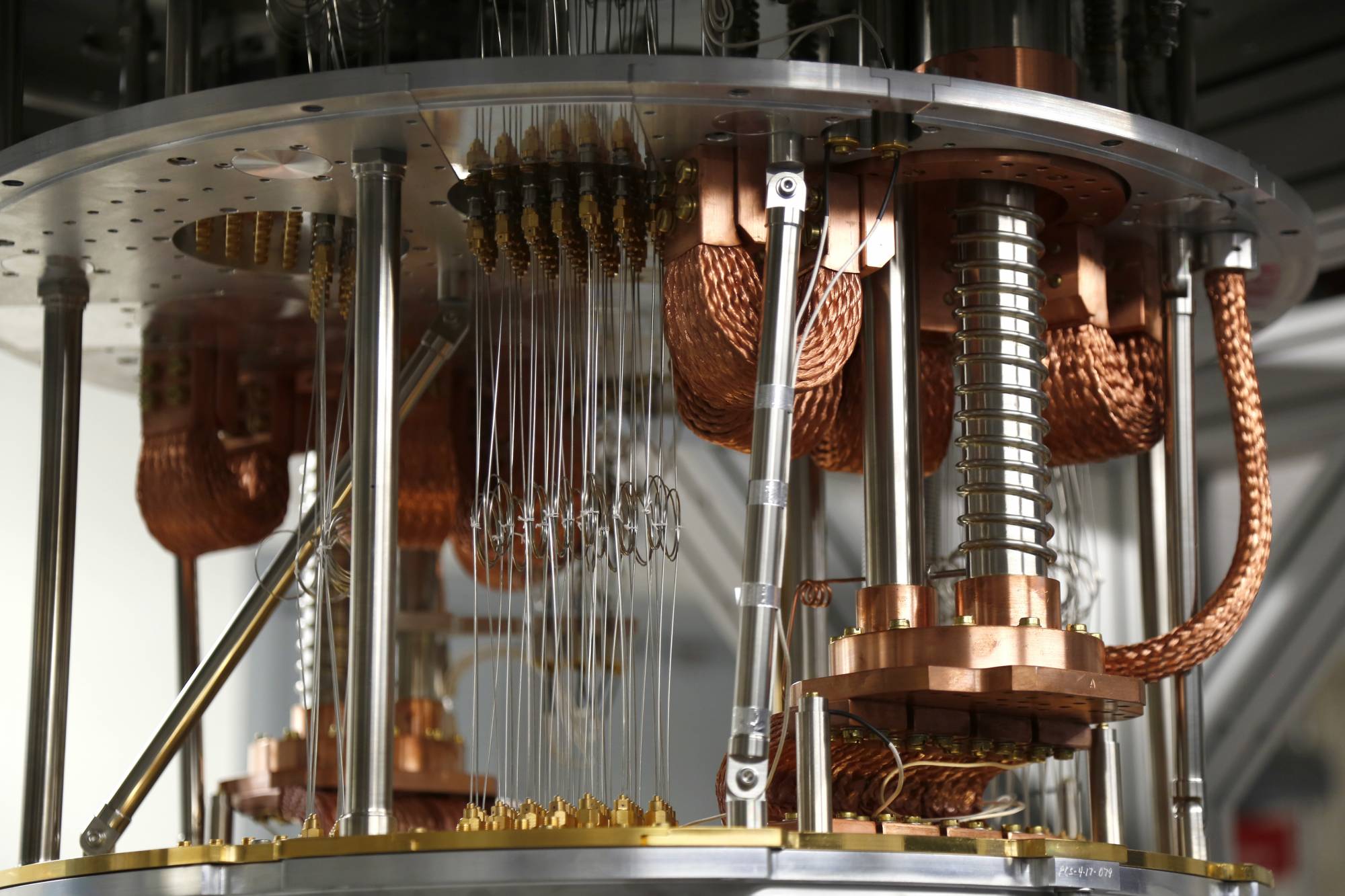
The U.S. Geological Survey has turned to quantum technology to help it with the next generation of challenges in geological science. It established a Cooperativ...
The U.S. Geological Survey has turned to quantum technology to help it with the next generation of challenges in geological science. It established a Cooperative Research and Development Agreement (CRADA) with a quantum company called Q-CTRL. For details, the Federal Drive with Tom Temin spoke with Jonathan Stock, the Director of the USGS National Innovation Center.
Interview Transcript:
Tom Temin First of all, let’s begin with what problems USGS has that you’re trying to solve, that quantum technologies will help. Then we’ll get into what the quantum technologies are.
Jonathan Stock Let’s bring in your listeners, and many of your listeners will be aware that we are in the middle of an energy transition, and we’re moving into a future where we use electricity in different ways, and we want to store that electricity, and that takes minerals. And it turns out that the minerals we need to store are electricity and batteries. While that technology is constantly changing and we may see new minerals come on, right now, the minerals we need are in short supply and subject to disruption from, let’s say, political events. So we have a national need to improve our ability to detect and assess those minerals in the subsurface.
Tom Temin All right. And so how do we do it now and how would quantum technology help improve that.
Jonathan Stock So ideally we would walk around with a large flashlight that would shine into the subsurface. And we would see the things we need. Sadly that flashlight does not yet exist. And so instead, we depend on a host of geophysical techniques that are in essence, ways of sounding the subsurface. For instance, some of my geophysical colleagues will fly gravimeter over Earth’s surface and measure gravity. And the interesting thing about gravity is that we’re taught that it’s 9.81m/s per second. It actually varies a great deal when you start moving out into those decimal places. And the reason it varies, is because there are rocks of different density in the subsurface. So one of the tools that my geophysical colleagues have to map the subsurface is by measuring very precisely gravity. And when you lose your gravimeter, which measures gravity over a big dense body, the spring extends a bit more because gravity is a bit higher over that really dense body, it’s attracting mass. And so if you’re canny, you can fly your preventer around and measure variations in gravity. That tells you something about what’s in the subsurface.
Tom Temin Right. And it can tell by the reading whether it’s lithium or ion.
Jonathan Stock Well, we’re not that good yet, but it does tell us bulk density. And so one of the things that we try and do as geologists is we try and paint a picture of what the structure of the subsurface is. We use lots of different techniques. And in this case I’m focusing on gravity, as it’s well relative to the sensor that we’re going to talk about the quantum sensor. So we use gravity and we attempt to differentiate rock bodies in the subsurface. What does that mean? It means that we tell a big dense rock from a light rock. And so for viewers for instance, granites are typically a relatively low density rock. That’s the light stuff that often winds up in our countertops, let’s say a basalt or a gravel or a dark and dense rock. And so we can essentially tell where those rock bodies are in the subsurface. And then if we’re really canny, it’s guilt by association. We can look at the geometry of that rock body and say, well, this geometry suggests that this is a mineral deposit. And then we go to secondary tools to find exactly what kind of minerals are in that. So it’s guilt by association. And it’s about imaging that structure in the subsurface and improvements. And so the quantum part is a dramatic improvement.
Tom Temin All right. Yeah. So what is the quantum technology I mean you mentioned a spring, I guess that’s a term of art. But there’s something pulling down. And then you get a readout.
Jonathan Stock That’s the old school. Like for those of us who’s suffered through physics classes in high school or maybe even college, you had a spring, and you watch how that spring changes as it gets accelerated by, for instance, gravity. The modern day survey hires contractors who take very large gravmeters. These are sort of like small Volkswagen sized perimeters. They fly them around in planes. It’s very expensive. And we get a relative sense of what gravity looks like, and we can turn that into a subsurface map. Now notice the challenge is there. One of the challenges is it’s really expensive. So we don’t do a lot of it. Or at least we don’t do as much as we’d like. And the other challenge is it’s really big. And so therefore we typically only do it over large areas. So the promise of quantum in this case is to shrink the size of that gravmeter and also at the same time to either keep the accuracy or even in some cases we hope to improve it. And so we’re talking about taking an old instrument that’s large and expensive. And turning into a much smaller, lighter weight instrument that’s less costly. And that means that we get to shine our flashlight into the subsurface many more places with much higher resolution.
Tom Temin We’re speaking with Jonathan Stock. He’s director of the National Innovation Center at the U.S. Geological Survey. And the fact that you have a CRADA with this company that makes this quantum technology. Sounds like this is not something that’s commonly commercially available then yet.
Jonathan Stock Not at all. And in fact, as the name implies, it’s research. So we are working with Q-CTRL, and of course we’re interested in other partners as well, to explore whether their software and sensors have the capability of getting us much lower cost, a much higher resolution subsurface data. Of course, it’s a CRADA, it’s a cooperative research and development agreement. So well, will it work? We don’t know. It’s research. We have a strong belief in this company and some of the others in the field that they have developed the tools that it takes to interpret this quantum data. And in fact, if you talk to them, they’ll tell you that one of the ways they do that is they’re essentially watching how atoms fall in the Earth’s gravitational field. So you’ve got this instrument, you’re flying it around on a small platform, maybe it’s a drone, maybe it’s an airplane, and then you’re essentially watching how atoms fall inside the instrument, because the rate at which they fall tells you, well, the gravitational accelerate. Now imagine all the challenges to doing that while you’re in motion. It’s kind of like riding a unicycle and doing trigonometry at the same time. Because the atoms are moving around, not just because of Earth’s gravitation, but also because, well, the plane is moving or the drone is moving. It’s moving up, it’s moving down, it’s moving sideways, it’s rolling. So all these different accelerations also influence. And then on top of that, there’s the inherent noise that’s in quantum techniques. And so the premise of do control and other companies like that is that they can essentially do all the calculations that are required to remove that noise. That’s the trigonometry on a unicycle.
Tom Temin And what is the nature of the sensor that would be pointed down there that contains the atoms? And just give us the big picture here. There’s some atoms in it. What kinds of atoms are they in? What’s looking at the atoms?
Jonathan Stock That’s a great question. Q-CTRL, of course are the experts here? But essentially, we are shining lasers through these falling atoms and using diffraction patterns to tell us the rate at which particular atoms are falling. They have a variety of different elements that they use. And of course, there’s a research industry built up around this. As you can imagine, the real challenge here is in taking all the noise out, because people have learned with some degree of confidence how to do this problem, when we’ve got a big sort of Volkswagen sized instrument sitting stable on Earth’s surface, or relatively stable. The challenges, ok, well, now what happens when you make it a lot smaller and start moving it around? And that’s where all of this sort of trigonometry in the news cycle comes in, because you got to take out all the accelerations from not being still and all the inherent noise in that quantum system. And for the details of that, I mean, that’s a Q-CTRL question there. They’re good at that, and I wouldn’t want to speak over them on it.
Tom Temin And with respect to just quantum measurement of Earth phenomena besides gravitational fields, are there other things potentially that could be measured?
Jonathan Stock Yes. But we also have an interest in working with them on another geophysical measurement called magnetometry, which is essentially measuring the direction and strength of the magnetic field on Earth. And you can imagine for similar reasons, if you have charged particles, they will orient. And once again, you can look at how those orientations happen at atomic levels and get, let’s say, if you can get the noise out of the system, very accurate readings of direction and magnitude for the little magnetic compass that’s sitting there in Earth’s field.
Tom Temin Now, at the moment, you happen to be tasked to NASA. So is that because they think this could be useful and not just here on Earth?
Jonathan Stock Well, we do have an interest. And as part of that, CRADA, we’re exploring the potential to use these kind of low size, weight and power sensors, in this case imagery and magnetometer or gravity and magnetics to explore for resources off world. As listeners will know, if you can take small, lightweight things off world, that don’t require a lot of energy, that’s a lot better than taking really large, weighty things that require a lot of energy. So small size, weight and power mean potentially, we could develop maps of the subsurface of off world bodies, whether that is the Moon or Mars. And by doing so, find the things that I think the nation needs from us, which are, well, resources, batteries for a new economy, volatiles on the moon, as well as potentially hazardous faults in the subsurface and let’s say sources of volcanic unrest.
Tom Temin And just a quick question on the computing architecture of this. If you have something flying over with the sensor on it. Artificial intelligence for the most part, algorithms require graphics processing units, GPUs. They use a lot of power. And so you would have to have a lot of computer up there. Or do you envision this something where the data is gathered, and then the analysis would be done when the drone comes back from that spot?
Jonathan Stock Well, as your listeners will know, that’s a trade space. So it costs energy to transmit data. It also costs energy to do calculations on board aka edge compute. And in this case, it looks like the trade space plays in favor of doing most of the calculations on board. And then using the resultant models that one might develop on your edge computer on board to direct the sensor where to fly to take the most impactful next measurement. So that style of data acquisition is called payload directed flight, or perhaps model directed data acquisition, and is premised on the notion that ultimately you’re flying the sensor around so that you can make a really good three dimensional model. And so why would you not build the model on the fly and then fill in the parts of it that look like they’re the lowest resolution? And so that again, I think that plays to the notion that edge compute is an important component here because it reduces the amount of power you have to use to send lots of data back to Earth to be processed, or let’s say, from a remote place on Earth.
Tom Temin And just a final question. Do you envision someday this technology will be refined to the point that those that would commercially exploit the existence of these rare earth elements would have a better idea of where to start looking and digging? Because that’s when it gets expensive, when you start trying to mine and refine.
Jonathan Stock Well, absolutely. And that is the appropriate federal role here, is to buy down the risk on these kind of technologies so that in the future we can reduce the impact of finding resources and extracting them. And the role of this particular CRADA is to test the notion that these technologies will improve our ability to shine that flashlight into the subsurface to find resources and hazards.
Copyright © 2024 Federal News Network. All rights reserved. This website is not intended for users located within the European Economic Area.

Tom Temin
Tom Temin is host of the Federal Drive and has been providing insight on federal technology and management issues for more than 30 years.
Follow @tteminWFED
Related Stories
U.S. Geological Survey team earned SAMMIES nomination with Hawaii volcano coverage