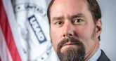
A lot of what USAID does relies on this geographer
Geographic information is crucial to agency missions almost everywhere. And it's especially true for the U.S. Agency for International Development.
Best listening experience is on Chrome, Firefox or Safari. Subscribe to Federal Drive’s daily audio interviews on Apple Podcasts or PodcastOne.
Geographic information is crucial to agency missions almost everywhere. And it’s especially true for the U.S. Agency for International Development. It operates throughout the world and for how geo and geo information systems underlie development decisions, the Federal Drive with Tom Temin turned to the USAID’s chief geographer Carrie Stokes.
Interview transcript:
Tom Temin: Ms. Stokes, good to have you on.
Carrie Stokes: Good to be here. Thank you.
Tom Temin: So tell us first how geographic information does underlie what USAID does. I mean, you have locations, countries around the world where development work occurs and is overseen and funded by USAID but how does specific geographic information figure into all of this?
Carrie Stokes: Well, as you know, USAID works in about 100 countries around the world. And we are focused on improving the lives of people in those countries. We work in many different sectors so everything from health and education, conflict and stabilization, environment and climate change, the list goes on and on with the many sectors we work in. So the geographic approach to development is an important one that I work to promote with a team of geographers and data analysts in the GeoCenter that I lead. And the idea here is to get a full picture about what’s happening in the countries where we work, not just in a sector-based silo approach that is typically the way many organizations operate. So what we do with geographic information is focused on where the development need is concentrated. We look at where we are already working as an agency. And we like to understand how effective our programs are. So all of that means we need geographic information, we need to understand the geography of the places where we’re working in the scale that we’re trying to target, where the communities and the people are that we’re working with.
Tom Temin: And is your geographic information simply pins in a map? Because the way describe it, it could be just well, there’s a poor area here, let’s put a pin there. And then you’ve got a nice push pin map of the country.
Carrie Stokes: In a simple form, the short answer would be yes, pins in a map are something that everybody’s really familiar with these days because we all use our mobile devices. And it’s easily accessible to see digital maps in this modern day that we all live in. But the work that the geographers and data analysts on my team does is a bit more detail than just visualizing where projects are based. We do analytics, and we take data sets that are disparate from many different places. So we’ll want to know, of course, where a project may be based, a health project, for example. But we want to overlay that, meaning we want to combine that information with what is the actual status of people’s health in that particular community or that particular district of a country. So we will look at things like mortality rates, we’ll look at what birth rates are like, we’ll look at distance that people have to get to a health clinic, for example, do they have access to basic health services? So we want to look at the spatial extent of the geographic influences that factor into people’s daily lives. So yes, there may be a pushpin here or there, but we’re also trying to get the context in which people live. So bringing in the different kinds of data sets gives us a fuller picture of what’s going on.
Tom Temin: Now, in the United States, there is a rich array of geographic information on almost everything conceivable down to the sewer line levels, that’s easily obtainable. What about some of the countries that are less developed, maybe not quite as open to society, perhaps as the United States? What are your sources of information, so that they’re willing to say yes, this is the death rate or the birth rate, or whatever it is, you want to overlay? How do you get that information?
Carrie Stokes: Well, we’re sleuths. We’re geographers, we’re good at looking for information that we know will be representative of people and a place. We look at demographic data. So the kind of data that’s collected in a census for example, some countries conduct their own in digital form, and they publish that information. And we will use that if we can’t get it directly from the country itself, there are other sources of household survey information that we really value. The World Bank publishes some of these. USAID, for whom I work, has been publishing an incredible demographic and health survey data set for almost 30 years or more. And these are very valuable pieces of information to combine information about people’s livelihoods, their health status, and then we also look at the biophysical information on the ground.
So we look using satellite imagery sometimes. We will look at high resolution imagery and zoom into a particular area of interest. That helps us better understand what the actual physical geography is like. So when we get to combine physical geography with human geography, as we say, it really allows us to ask deeper questions about what’s driving human behavior, what may be some of the factors affecting people’s decisions about where they get their food, if there’s a food insecurity situation going on. So we’re very creative about data. But we’ve also tapped into the open mapping data movement, as I will call it. There is a platform called OpenStreetMap and we use it. It empowers people who have access to the internet to create data that represents their own local communities geospatial data. And this data is made available to anyone who uses the platform. So we make use of this as well, we contribute to it, and we use it. But half the challenge for us when we’re going to analyze a particular area is in fact getting reliable, trustworthy data that we know is representative and timely.
Tom Temin: We’re speaking with Carrie Stokes, she’s chief geographer at the U.S. Agency for International Development. So it sounds like the importance of geo means that you probably help inform what surveys USAID does in the first place, in areas where it’s able to do surveys.
Carrie Stokes: We do and we feel it’s important when users of information have an opportunity to influence what information actually gets collected. So the user base of this information is growing and growing. It’s not just me and my team, we have a geospatial Community of Practice as we say, all throughout USAID. We have about 165 people, that’s pretty incredible given that we’re not a mapping agency, we’re a development agency. But the power of geospatial data and technology to help us really visualize what’s going on and where it’s happening, is continuing to grow. We’re living in a geospatial revolution and the kinds of data sets that are actually available today, compared to 10 years ago, when we started, well 11 years ago we started the GeoCenter, it’s incredible. And every day there are more datasets becoming available in the public domain that we can use.
Tom Temin: And you tap into the government’s own geospatial community, which is governmentwide and military intelligence and civilian.
Carrie Stokes: Yes, we do. So there is a federal geospatial community. It’s very vibrant, and has representatives, an interagency group from most departments and civilian agencies. And I’m part of that. I represent my own agency in that federal geographic data committee, as it’s known. We also have another interagency group known as the U.S. Group on Earth Observations, USGEO for short, because we have an acronym for everything in the federal government, of course. And I represent USAID with that group as well. And Earth Observations kind of sounds like a big fancy term, but it’s exactly what it says, it’s observing the Earth from space. We also have in situ measurements, as they’re called. So if you think about buoys in the ocean, collecting information about ocean temperature, ocean currents, being able to combine these incredible multiple sources of different data sets from around the world helps us better understand and sort of monitor the pulse of the planet. And this is especially important for climate change and understanding how our planet and climate are changing.
Tom Temin: Give us an example of say a USAID, suppose a decision is made. We want to give a grant to operators in this country to do this piece of infrastructure, say, and I’m just sort of making it up. How do they bring in the geographic information element, and dear people, help them make that decision? Give us an example of how this all works from a functional bureaucratic standpoint.
Carrie Stokes: Sure. Well, one of the things that we do, as I mentioned earlier, we have a presence in 70 countries around the world to include many in Africa. And when we are doing our strategic planning, so a five-year plan out as we decide what programs are needed on the ground, we do a major figurative landscape assessment and literal landscape assessment. It’s important for us to know what the trends are, what’s happening, what’s going on on the ground? What we decided to do five or six years ago may no longer be directly relevant today. We may need to pivot. So for example, in East Africa, we worked very closely with our colleagues on the ground as they were planning, they’re making their five-year plan. And looking again at these different data sets helped to illuminate this youth bulge as we term it. So the demographic of an age group, age about 15 to 25 is pretty critical group of people because those are the folks who are getting educated, who will be entering the labor force and being active in their own communities, becoming leaders in their own communities. But until we really looked at the data country by country and sort of zoomed out a little bit at the entire region of East Africa and visualized over time, so we can make time series visualizations and see over a 20-year timespan, how are the demographics changing? Get a sense about where are the people? How have they moved just in terms of population density?
That information is critical, because we need to know where the people are, are they hovering around a Lake Victoria, for example, and seeing the population growth there, that’s a key component of East Africa and the local and regional economy. So when we were looking at things like food security, for example, one of the analyses that we conducted in Uganda with the data showed us that the food security of a household is related to the literacy levels of the girls who live in that household. And this believe it or not, as a geographic issue, we can see where throughout the country, this is the case. So finding connections between sectors is sometimes illuminating for our colleagues, because now we can make decisions about, OK, we were investing a certain amount to improve food security in a particular area, do we also need to ensure that we’re investing in improving girls education opportunities in the same area? Of course, we all know that educating girls is important. But did we realize that the data was so strong to show that it affects food security of a household? So these are the kinds of insights that we can gain. Another example in Rwanda that we did was really illuminating. We learned through our geographic analysis that the Protestant community was reproducing and growing much faster than the Catholic community was.
Tom Temin: That’s a real revelation.
Carrie Stokes: Well, it is because in our culture with our context, our assumptions might have been the opposite. And this is important because the data and analytics can show us information can show us trends, especially when we can plot it out geographically, that can surprise us. It doesn’t replace experts and our expertise and experience, but it can really allow us to question our assumptions, to better understand what’s going on, and therefore target our programs effectively in the places where programming has been dismissed.
Tom Temin: In other words, it’s possible to decide to target development where things aren’t happening, if you want them to happen there. Or if you need to serve a population, then that’s where you do do the development. But either way, you’re not blindly landing these investments.
Carrie Stokes: Exactly, yes. And in today’s world, we have access to this digital data, digital technologies, high resolution satellite imagery, mobile mapping apps on our phones these days. It’s just an endless source of information that USAID did not have more than 60 years ago, when we got established.
Tom Temin: A good old fashioned topography is still part of the overlay that you need to know, too. Well, you can’t put a pumping station there, because it’s a 75-degree hill.
Carrie Stokes: You are correct. Topography is part of geography. Geography is really the study of place, and people and how they interact. So it’s extremely important. You wouldn’t want for example, to be necessarily digging a well at the top of a mountain, you’re going to have to dig far, far down. But if you’re looking at a flat map, and haven’t realized that there’s some topographic relief, with ups and downs, hills and valleys, you might make a decision without really knowing the full situation before you get to that location.
Tom Temin: And just briefly, how did you get to this point in your career as the chief geographer there?
Carrie Stokes: So I started at USAID, this is stating myself now, in the year 2000. And I was a climate change specialist when I first came in. And I came in with a background of having worked in Africa as a Peace Corps volunteer after college. But I also brought with me a background in geographic information systems, GIS as we call it, as well as the climate change science. And I had worked for a period of time for a private tech company that designed its own GIS software and hardware. So when I came into government, I was a little surprised that we weren’t using, even this was 22 years ago, the technology that I saw was really unfolding to become more readily available on the internet. So I continued in my work on climate change, then realized we needed to better understand how to track our progress for our investments, not just in our climate programs, but in all the programs that we invest in around the world. And it really made sense to me to start putting this information, collecting the location.
We didn’t have, at the time a systematic way of collecting the location of our USAID activities. We today do, we have policies in place, we are getting the IT infrastructure in place to be able to collect this and be able to analyze it. But that process was for me evidence that it was a gap. And today we’re filling that gap. So I initiated some efforts to start mapping the work that we do, and showing colleagues the power of that, and got involved in the interagency geospatial community as well. Started a program with NASA, our nation’s space agency, where by USAID, the development agency lead for our U.S. government and our space agency combined forces to create a program called SERVIR. And the SERVIR program is still going strong to this day, 17 years, I believe, at this point. And the idea behind that was to empower our colleagues in developing countries to get access to Earth observation information, mapping technologies, to help their ministries of health ministries of environment, disaster response ministries, agriculture ministries, and allow them to benefit from some of the same technologies and that we have in this data rich country of the U.S.
So that interaction with NASA, combining the climate change work and the geospatial technology work really led me to decide, OK, now we need to focus on empowering our own staff in USAID. So the GeoCenter that I established about 11 years ago was really like a small, SERVIR hub, as we would say. It was just embedded in the walls of our own headquarters office in Washington, D.C., so that our own staff could get access to the same kinds of technologies and data sets that we were promoting, with our colleagues in the many countries USAID works.
Tom Temin: Sure. Sounds like you really liked this work?
Carrie Stokes: I do. It’s great. Geography is the study of everything everywhere, so it’s never dull. And my team and I get to work across many sectors. And we get to work across many geographies. And what we learn in sort of the big picture analytics helps us really zoom into local scales when we’re working with local communities and our colleagues in country to take lessons learned from one part of the world that we’ve seen might be relevant to another part of the world. So it’s a fantastic opportunity, and I love what I do.
Tom Temin: Carrie Stokes is chief geographer at the U.S. Agency for International Development. Thanks so much for joining me.
Carrie Stokes: Thank you for having me.
Copyright © 2024 Federal News Network. All rights reserved. This website is not intended for users located within the European Economic Area.


Tom Temin
Tom Temin is host of the Federal Drive and has been providing insight on federal technology and management issues for more than 30 years.
Follow @tteminWFED