Hubbard Radio Washington DC, LLC. All rights reserved. This website is not intended for users located within the European Economic Area.
On Air: Federal News Network
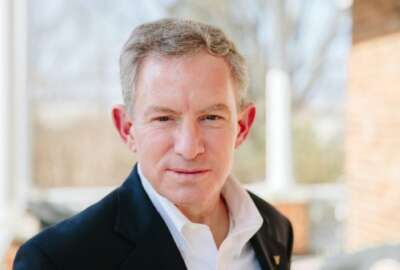
This USDA scientist does work that is down to earth
Farming these days is a downright scientific enterprise. Precise measurement of soil, water, air, and seed conditions all figure in. The work never stops for sc...
Farming these days is a downright scientific enterprise. Precise measurement of soil, water, air, and seed conditions all figure in. The work never stops for scientists at the Agricultural Research Service. One of them has been named a meritorious senior professional in this year’s Presidential Rank Awards. The Federal Drive with Tom Temin talked with Dr. Bill Kustas.
Interview Transcript:
Tom Temin And you’re toiling away there at the Agricultural Research Service in Beltsville, Maryland. And tell us about your work. It seems to concern something pretty vital to farming, and that is the interaction of soil with moisture in the atmosphere and so on.
Bill Kustas My research has been in the development of foundational advances in the measurement and theory of plant water use, also known as a evapotranspiration, or in short, ET, its application in climate and water sciences and their connections to water resources management.
Tom Temin That sounds like one of the grand challenges then in agriculture, especially as water supplies get squirrely or dry up in different areas, is just the minimum amount of moisture applied to get the crops to grow properly without wasting a drop. Is that the general theory of that you’re working on?
Bill Kustas Yeah. So we’re trying to develop the technology using remote sensing, principally from satellite observations, to help in determining the actual plant water use. And that information becomes essential in trying to develop water use efficiency measures to improve the application and conservation of water resources.
Tom Temin And what is in satellite imagery that can tell you that.
Bill Kustas So one of the key inputs that we use is land surface temperature. And the temperature you can think of for plants is critical because plants regulate their temperatures to develop the biomass and to ultimately affects yield. So temperature is tightly coupled to water use. So plants bring in carbon and they lose water as well. But that water helps regulate their temperatures. So by observing the temperature we have an observation of the plant condition and how it’s doing.
Tom Temin And how does that translate say, to an individual field where temperatures vary from county to county or even from within a zip code, this type of thing? Can this also be coupled with measuring things right there on the ground in this soybean field here?
Bill Kustas Yeah. So with satellites and in principle, Landsat. So the land satellite system has a resolution that looks at temperatures down to almost 30 meter resolution. So within field observations are possible with this satellite system. And that can be used in combined with a modeling tools that we’ve been developing to estimate the amount of water loss in individual fields.
Tom Temin Got it. So would you call this, say applied research. That is to say, if you determine this is the rate of water loss in this area, how does that translate into what say a farmer should do in a given spot.
Bill Kustas Right. So this type of information can be made available to farmers. And it’s starting to do with the open ET project that is a NASA, USGS, involves universities as well as Google Earth engine and also nonprofit, including the Environmental Defense Fund that are developing this technology so that farmers can actually go to a website and actually look at their fields to see how they’re doing in terms of water use and conditions, in terms of stress and so forth. So this information can ultimately be applied and used by farmers to help determine amount of water being used and how they can regulate it to better levels.
Tom Temin We’re speaking with Dr. Bill Kustas. He’s a scientist at the Agricultural Research Service and the recipient of a Presidential Rank award. I guess farming, then, is all about fine tuning to local conditions these days, as opposed to just running the sprinkler for an hour like we did in the early 20th century.
Bill Kustas Yes. So with some of this new technology that’s being offered, farmers have the type of information that they can improve upon their irrigation management and scheduling. And that becomes really important as we deal with droughts, more frequency of droughts, for example, and that becomes a real important input now that farmers and growers can use.
Tom Temin And in the course of examining this over the years, I wonder if you’ve come across besides watering techniques and strategies more about what certain types of crops and seeds do better in different conditions, and maybe fine tuning what’s planted as well.
Bill Kustas Yeah. That’s true. Some of this work is now being used in evaluating different genotypes for crops. What they’re finding is that the ultimate yield and water use are so tightly coupled that they can start to develop crops that utilize less water but maintain acceptable yields, especially in areas that are water limited.
Tom Temin Yeah. So you’d call that agricultural productivity I guess, right.
Bill Kustas Right. In terms of its productivity, there’s a term called drop per crop. In terms of trying to maximize yield for the amount of water available to apply.
Tom Temin Now you’re a presidential rank award meritorious senior service. Is this because of this project with NASA, USGS, ARS and Google Earth and so on? And what did they tell you they gave you the award for?
Bill Kustas So it’s really about the work that I’ve done, laying the foundational modeling effort that can utilize satellite data and produce reliable water use and plant stress estimates. And because this modeling tool is robust enough that it can be applied to various landscapes and conditions, it’s being used in both the open ET project, which has started out west and is expanding across the continental U.S. to be applied, as well as in the European Space Agency. They have a project using their suite of sentinel satellites that they have orbiting, and they’re utilizing this modeling tool in terms of doing even things at a global scale.
Tom Temin Interesting. And just personally, how did you come to this particular branch of research?
Bill Kustas Well, it really started with my PhD work at Cornell with my advisor. He was developing the theory of using atmospheric information to get at evapotranspiration. And when I came to USDA, they were developing remote sensing methods. And I was then able to tie what I was doing and the atmosphere, what was happening with the remote sensing aspects and coupling those into what we have today.
Tom Temin But you didn’t come out of the Iowa cornfields where your dad labored for years and years and years. That’s not the story here?
Bill Kustas So initially I was doing this type of work in natural ecosystems, but it transferred easily over to what we do in agriculture and realized that agriculture includes grasslands, prairies. These are all part of agriculture, they’re all utilized by agriculture. So it’s more than just soybean and core that we’re dealing with.
Tom Temin Yeah. And do you find that at the Agricultural Research Service? That sounds like a place that’s supportive of lots of ideas. And the daily life is very much data driven and research oriented, sounds like.
Bill Kustas Yeah, they really support the basic research as well as applied. And they realize that some of this basic research takes considerable time to develop into something that ultimately becomes operational. The work that I’ve been doing, which started 30 something years ago, is now coming to fruition. And now that we have the technology capabilities of making this data available and more routine methods, including ultimately on on your smartphone is the ultimate goal where farmers can go in the field and actually see their field from their phone.
Tom Temin And as more and more commercial entities launch more and more fine grain satellites, it sounds like the potential in the future is to get even more detailed and more resolution at what’s looked at.
Bill Kustas Yeah. That’s true. There are commercial entities out there that are developing small satellites that orbit lower to the atmosphere, so they can set up a suite of satellites to give more information. And most importantly, if we can observe what’s happening, then we can predict what’s happening. So observational measurements are really key in being able to continuously monitoring what’s going on the Earth’s surface.
Tom Temin And just a final question. Ultimately, with this open ET project, why only farmers? Could someone say a homeowner say, I want to get this fescue even greener. Now I know on my phone exactly when and how to water it.
Bill Kustas Well some of the work that’s ongoing is understanding the urban environment, understanding water use by golf courses and other entities that grass grown in urban environments, and these types of satellite observations can be used to better understand again developing water saving strategies in urban environments, and also how important green space is in urban environments, in dealing with heat waves and so forth that are becoming more and more prevalent.
Tom Temin And maybe it’s time to learn how to put on a sand green. Dr. Bill Kustas is a scientist at the Agricultural Research Service and the recipient of a Presidential Rank Award. Thank you so much for a fascinating piece of insight.
Copyright © 2024 Federal News Network. All rights reserved. This website is not intended for users located within the European Economic Area.

Tom Temin
Tom Temin is host of the Federal Drive and has been providing insight on federal technology and management issues for more than 30 years.
Follow @tteminWFED
Related Stories